The Tongariro Alpine Crossing

Sorry for the delay. I haven’t had internet for a few days. I am still writing stuff on my iPad and saving it for when I do have internet. It cost $20 for 100Mb of Wifi. Yeah….seriously. I bought one pack and forgot to turn off auto updates on my iPad. 100Mb were gone in 5 minutes. Screw it, I wasn’t paying another 20 bucks for that.
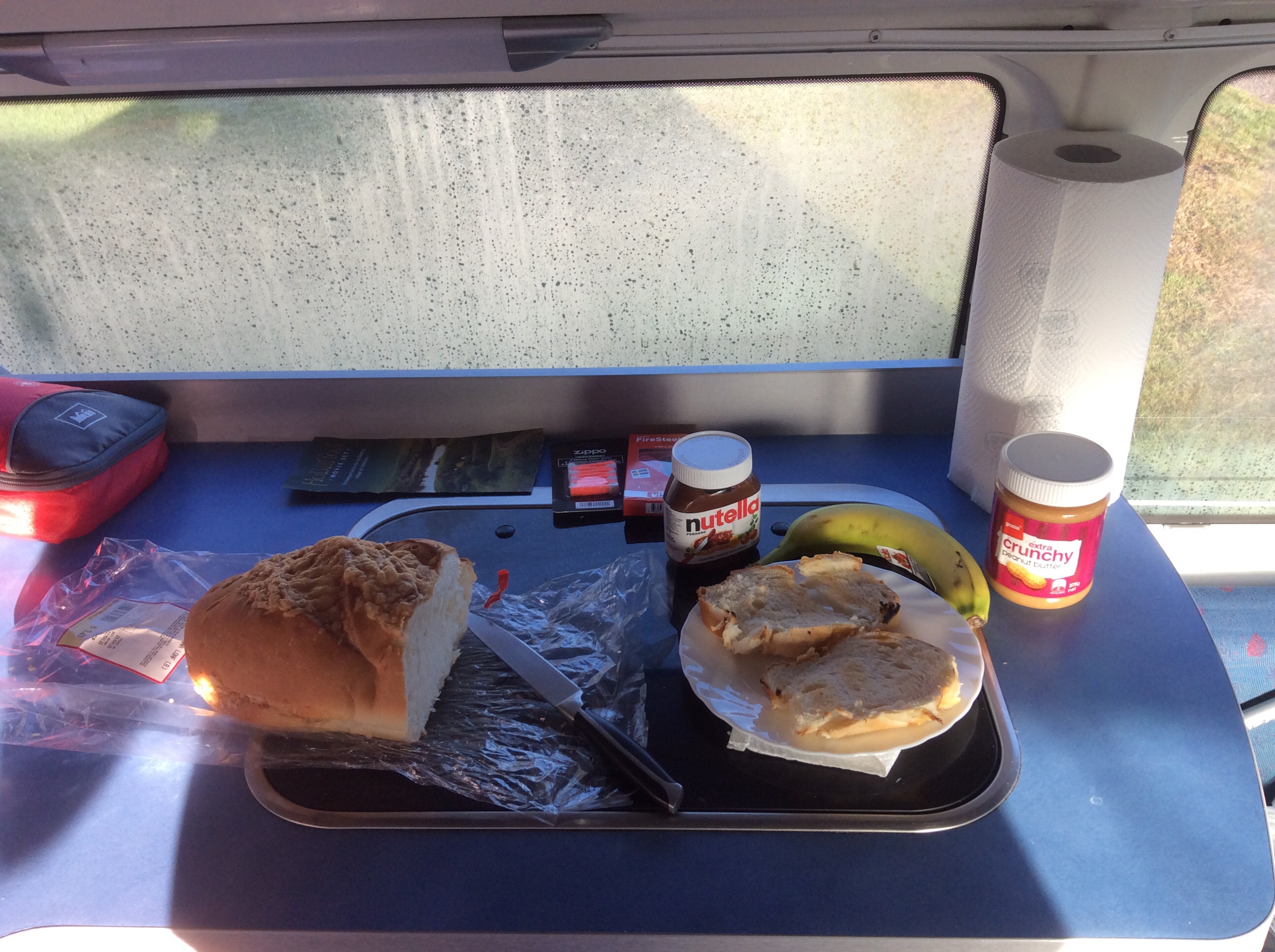
March 21:Today went from a super chill day to an overpacked day. I woke up with a frozen face (it hit 3*C overnight; pardon the use of asterisks as degree symbols, but I don’t see the symbol anywhere on here) but the rest of my body was surprisingly warm. I showered up and made the breakfast of champions in the van. Two slices of toasted cheesy bread (I couldn’t find a full loaf of bread without cheese on it), peanut butter, nutella and a banana. Go time. The skies were as bright blue with a few clouds scattered in between for some great skylines. It looked like the weather was going to be great today.
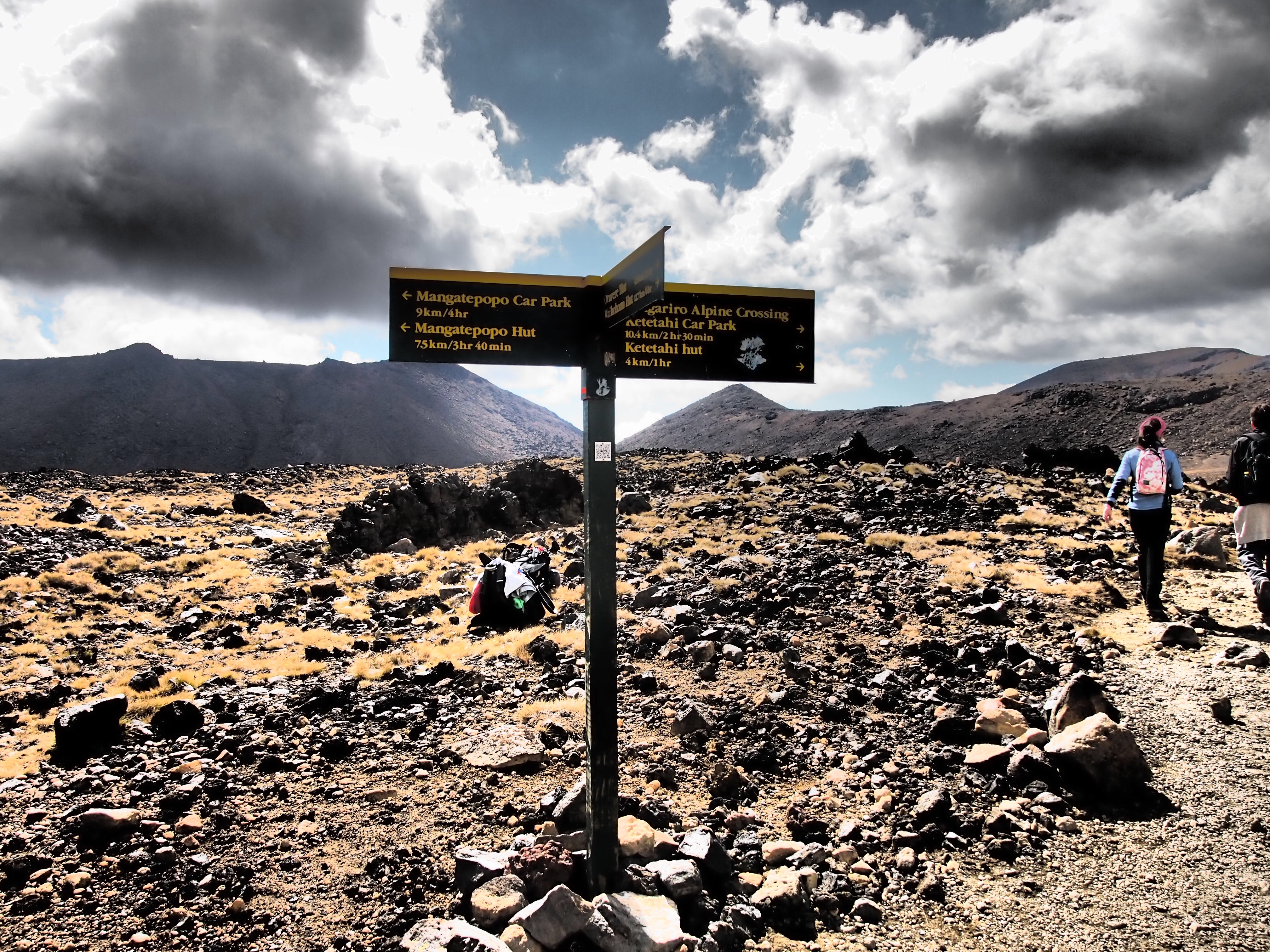
I looked for reservations on the ferry to the south island but they were sold out for the day so I booked one for the next morning at 8:30am. Looks like I have all day to work my way down to Wellington (4 hour drive) and wander around the city for a bit. Since I had all day, I figured I’d find out some information on the Tongariro Alpine Crossing so that I’m ready for when I head back up north. I work my way to an iSite (travel centers throughout the country) a few blocks away from the campsite around 10:00am and ask for information on the hike. The super nice lady working there asked me if I was trying to do it today (insinuating I’m probably too late) to which I replied, “Can I still make it today?” She thinks about it and then asks me if I’m a fast hiker. My ego didn’t let me say no so I replied “I’m OK, I guess” (silly me). She didn’t seem to be too put off by this and then states, well if you want to go you have to be ready to go NOW. I said, I’m IN. Some of the craziest words uttered on this trip thus far. She then says, “The hike start point is an hour north of here and you will need 6-8 hours to finish the hike (online/brochure said 7-9, but this is not the time to point that out). By the time you drive up there you will have six to six and a half hours to finish the hike before the last shuttle pick up on the other end of the hike 19.4 km away. You will have to go fast and not do any side trails. There are NO shuttles after 5:30 pm.” She emphasized the last part. She books me on the return shuttle, takes my money and points me to a store across the street to grab a few essentials (sunblock, water, snacks). I rush through the store and pick up the items including some trail mix and a box of muesli bars and start driving north. After an hour drive, I find the car park which was jam packed. Cars resorted to parking on the side of the road due to lack of spaces. Luckily someone was leaving as I pull in so I have a good spot. I change over to my hiking clothes, pack my bag, rub some sunblock on, leave a mess in the van and take off in blur hoping I didn’t forget anything. I learned a bit from the first hike in Auckland and leave more stuff behind for this trip. Nearly all electronics stay behind except for backup battery (though I forgot my iPhone cable so that was useless) and pack only a few extra layers of clothes, extra socks, 2.25 L water in camelback, box of muesli bars, trail mix, and random crap like sunblock, passport and keys. Start time 11:15am (time to shuttle 6h15m).
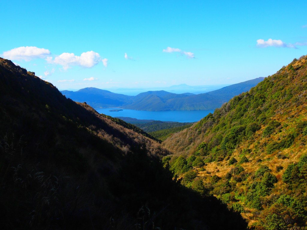
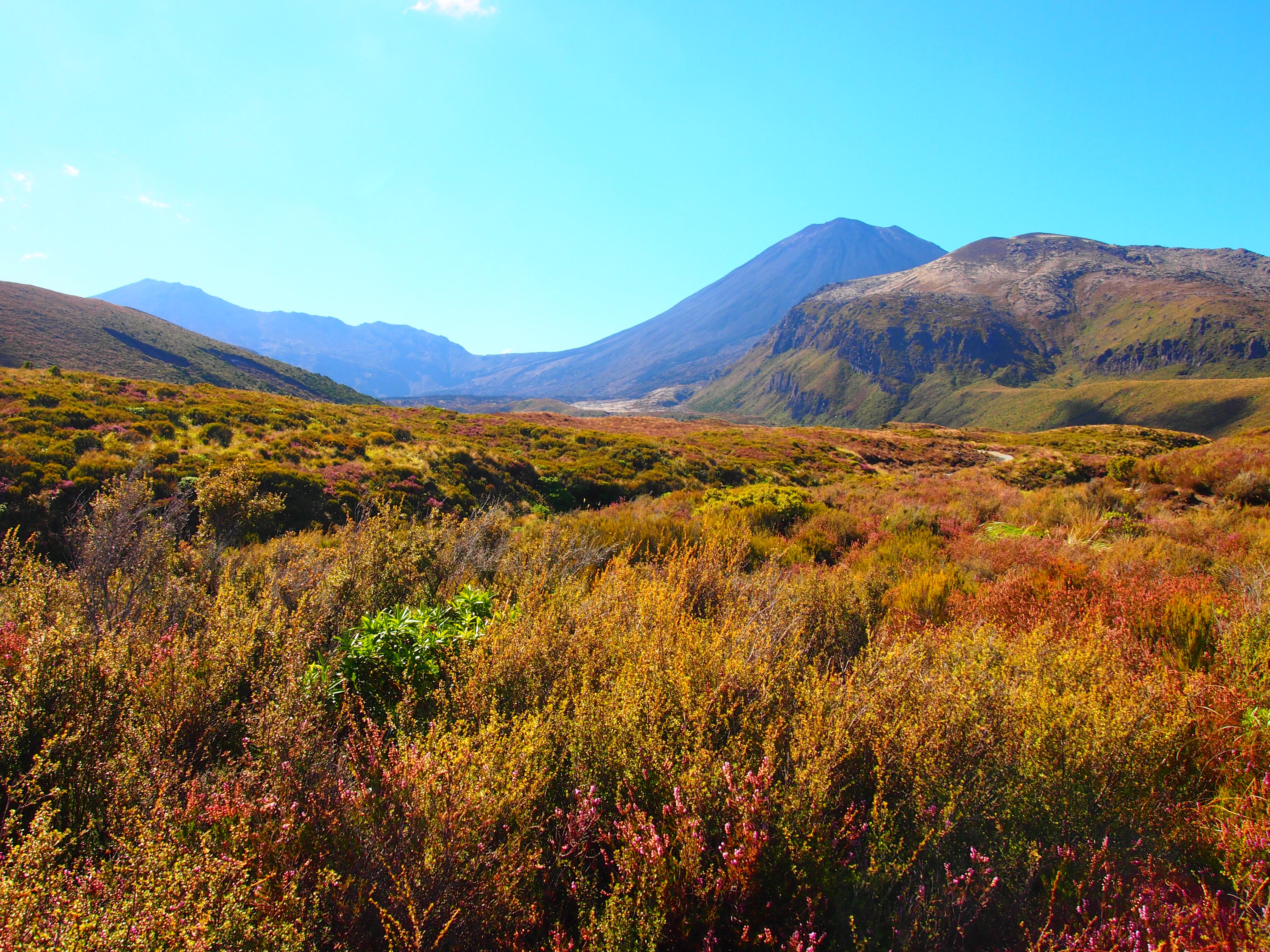
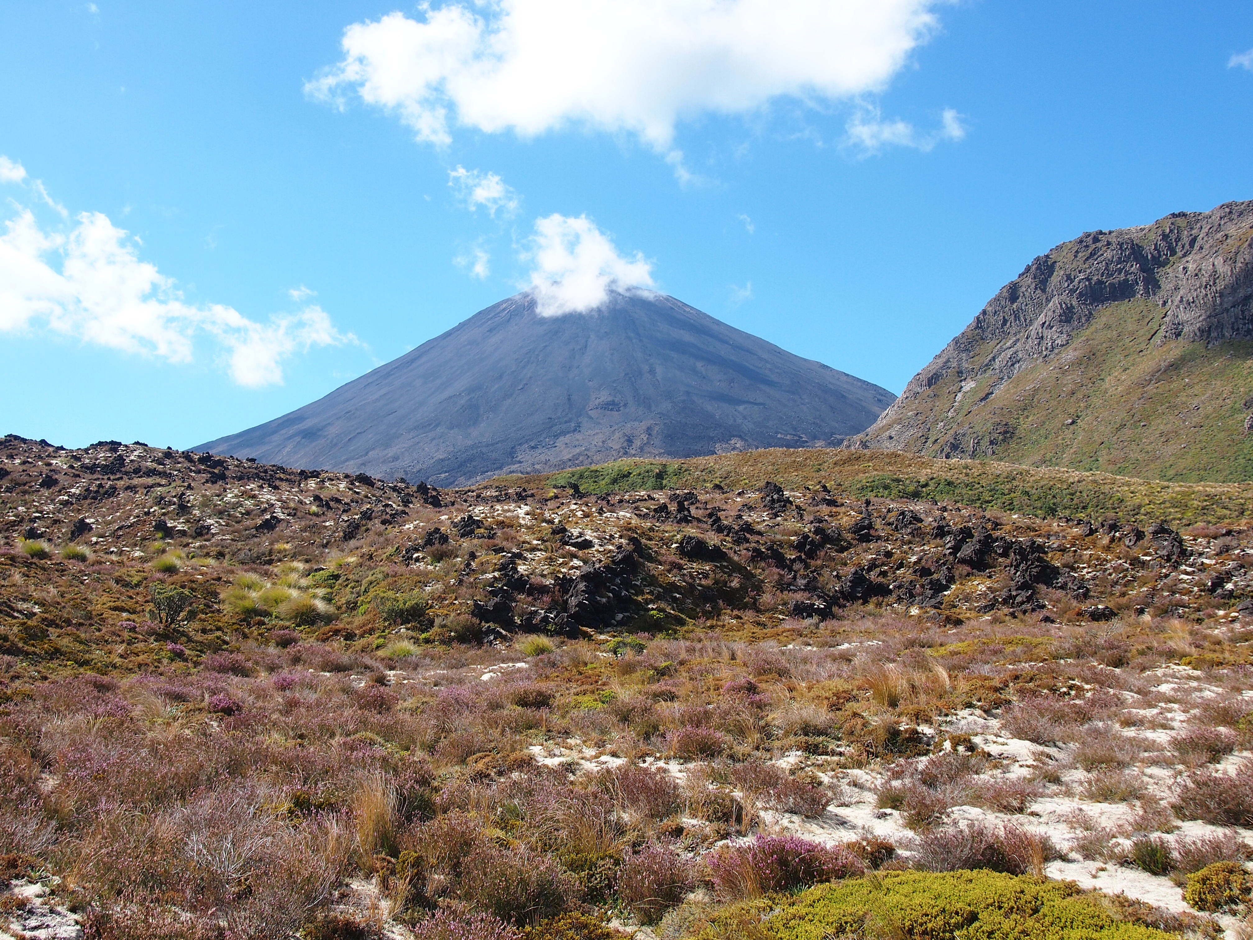
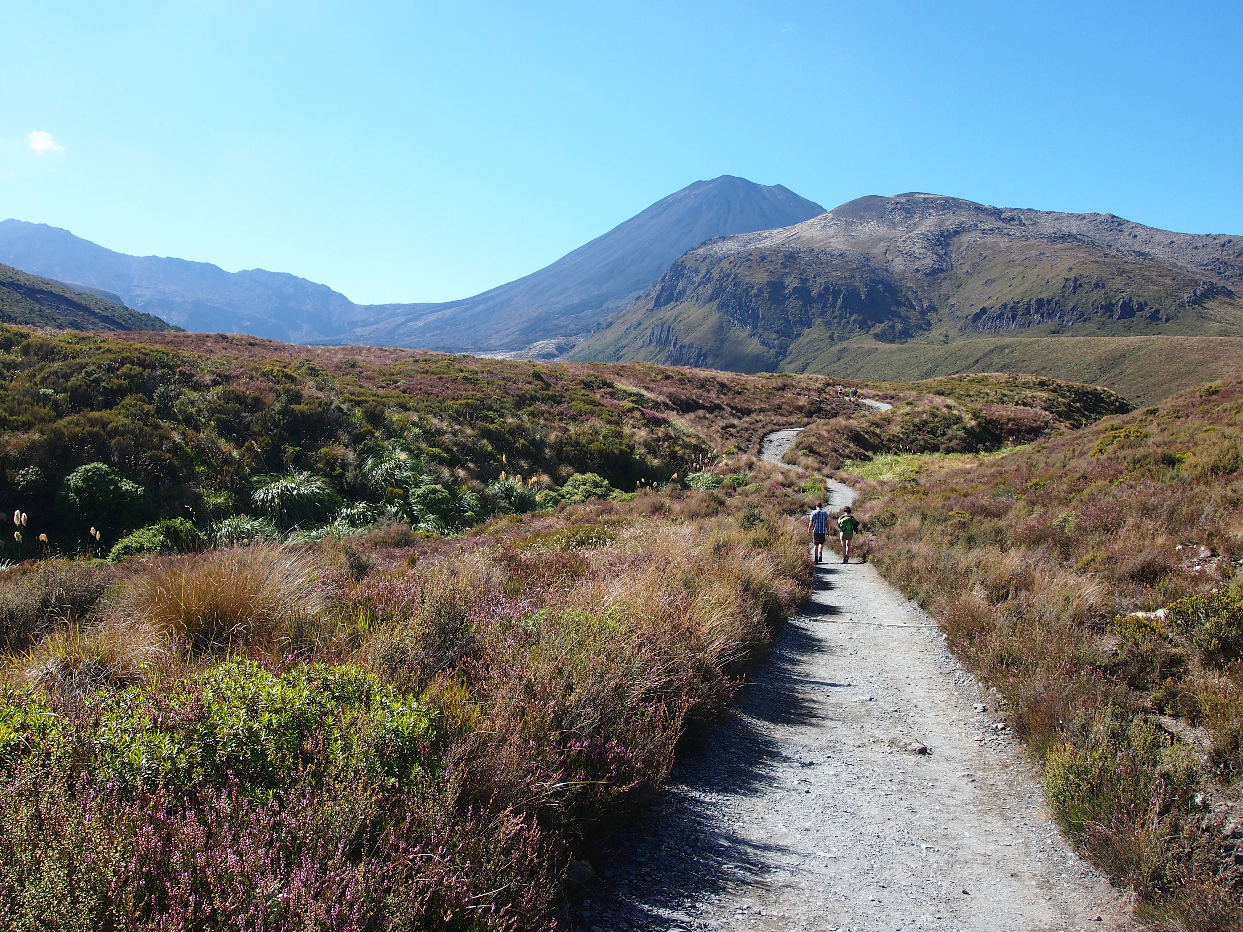
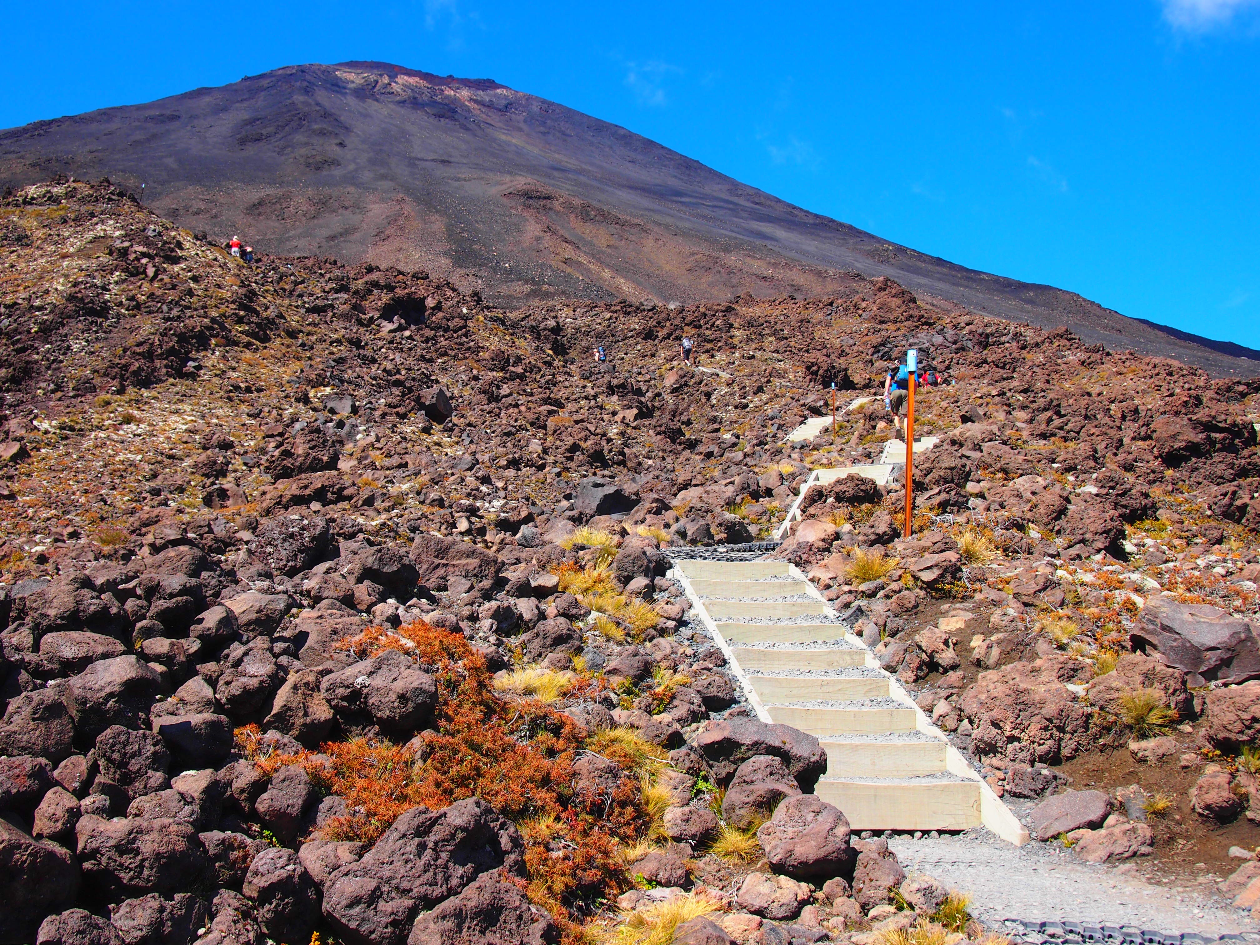
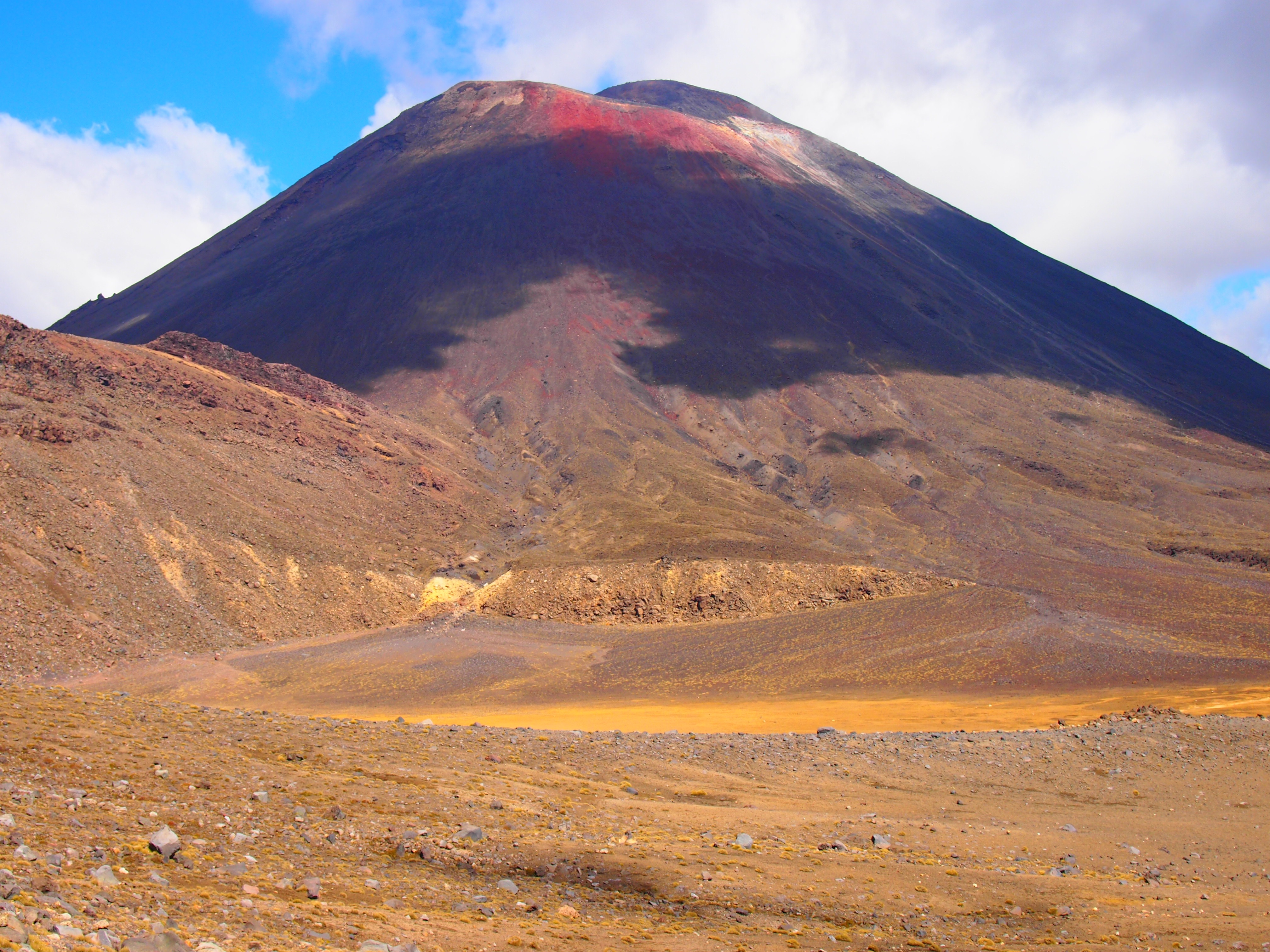
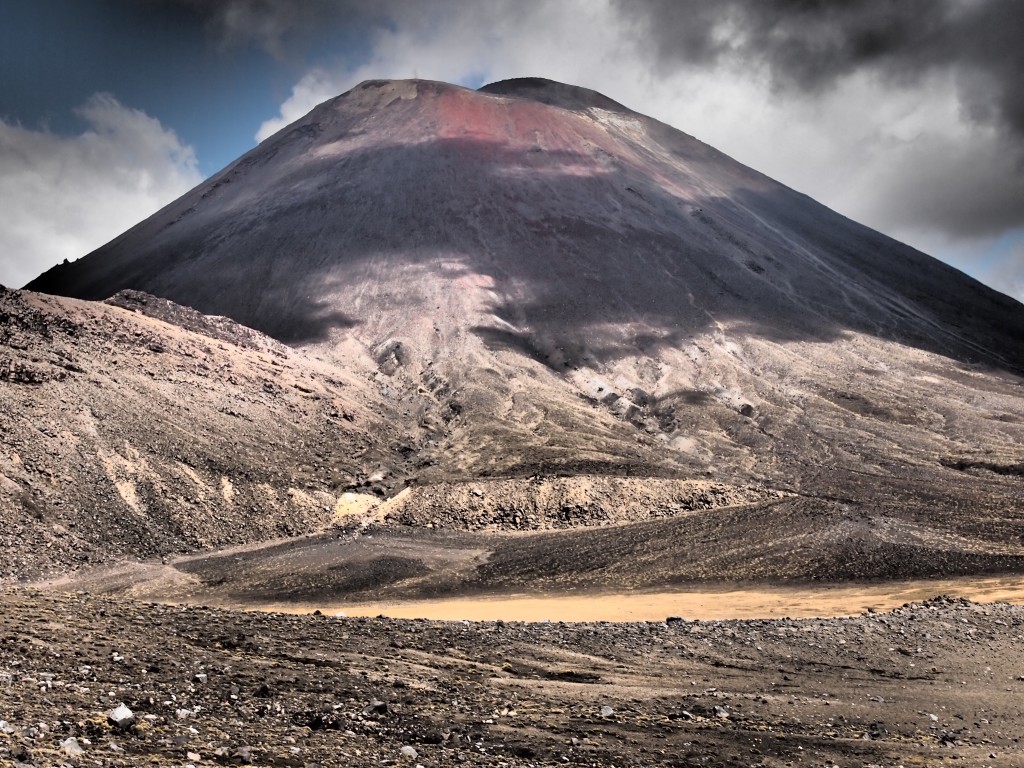
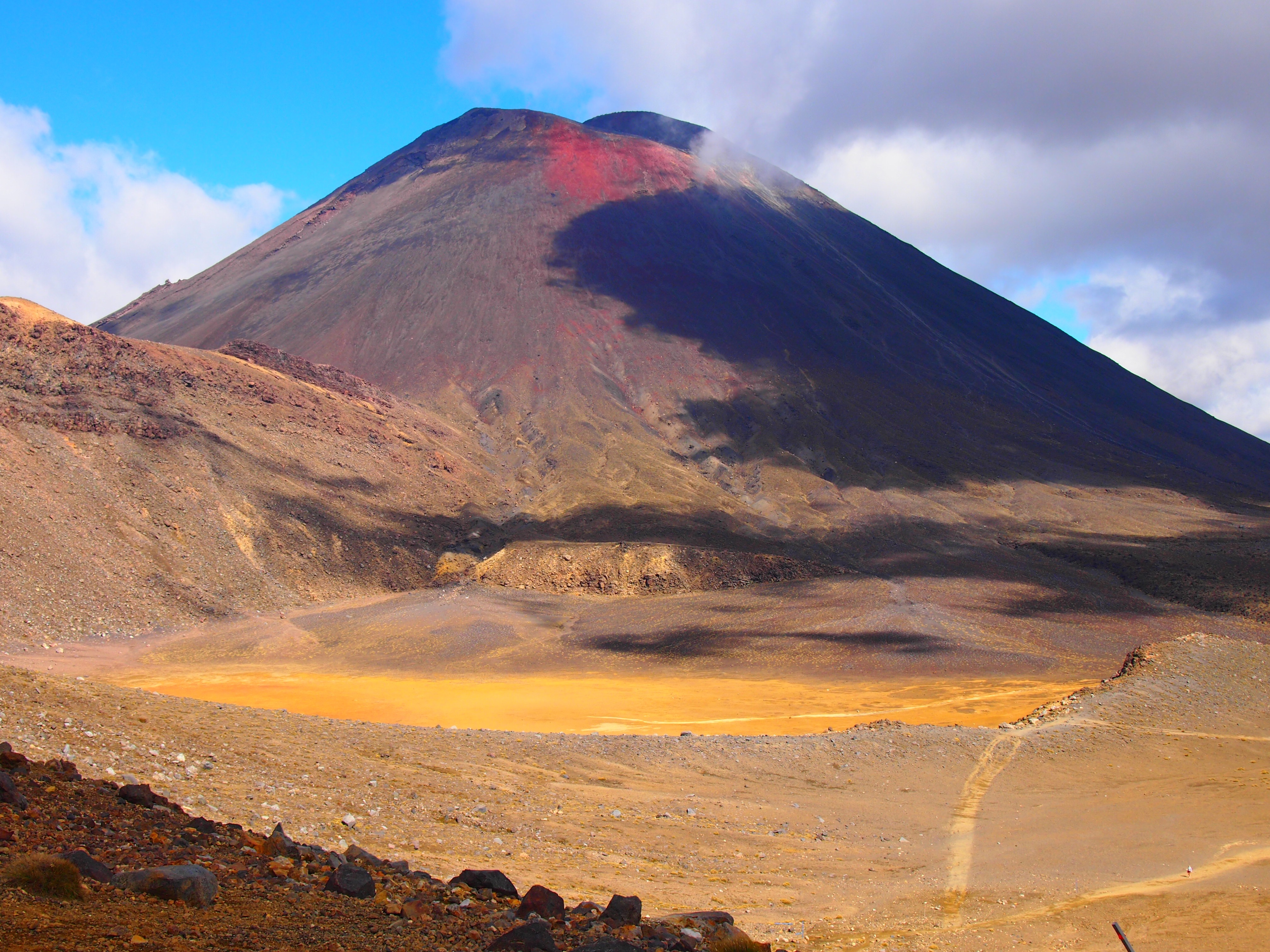
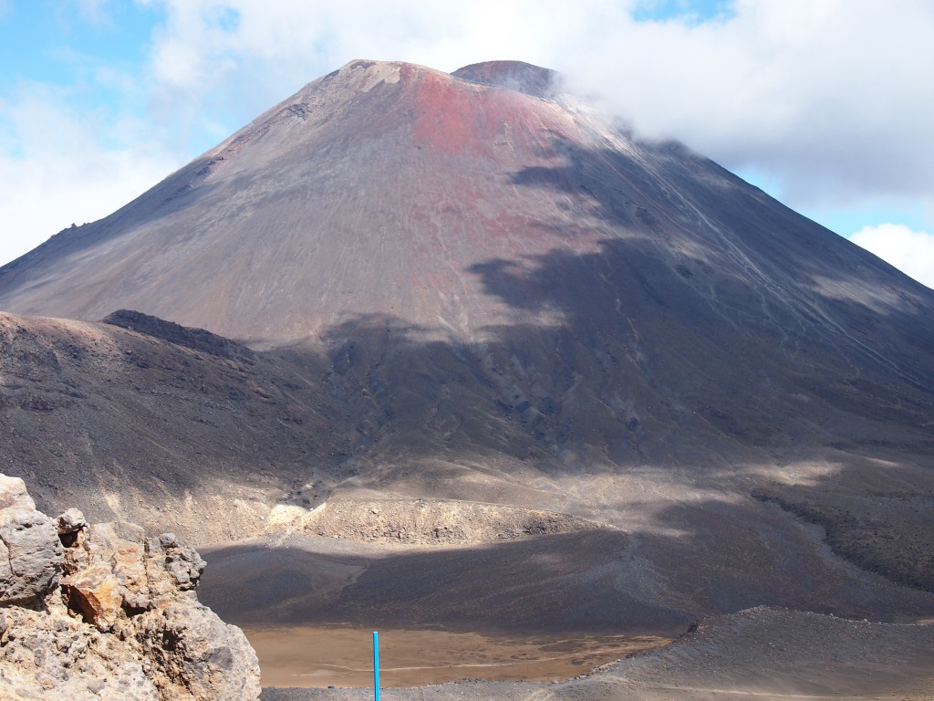
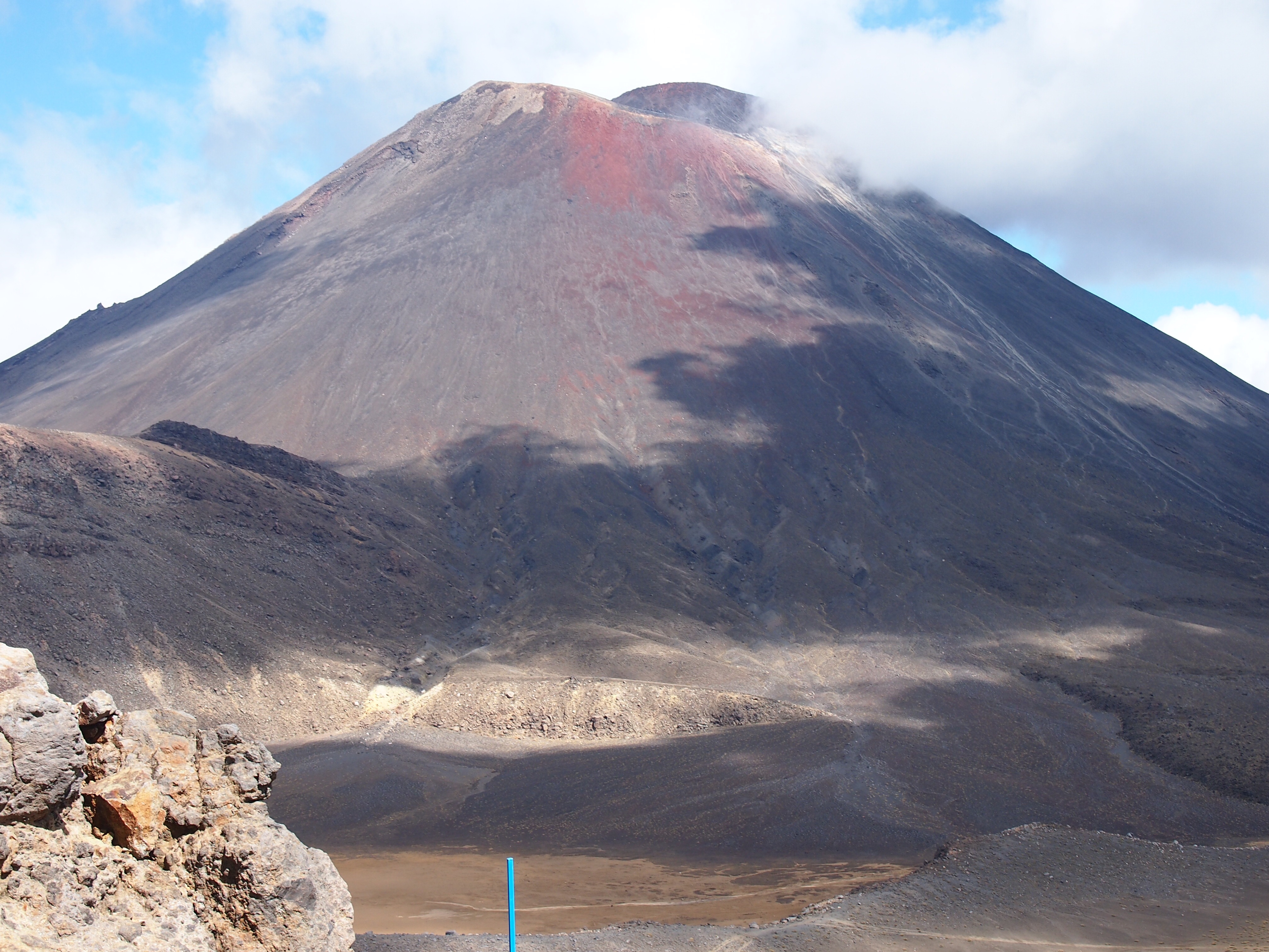
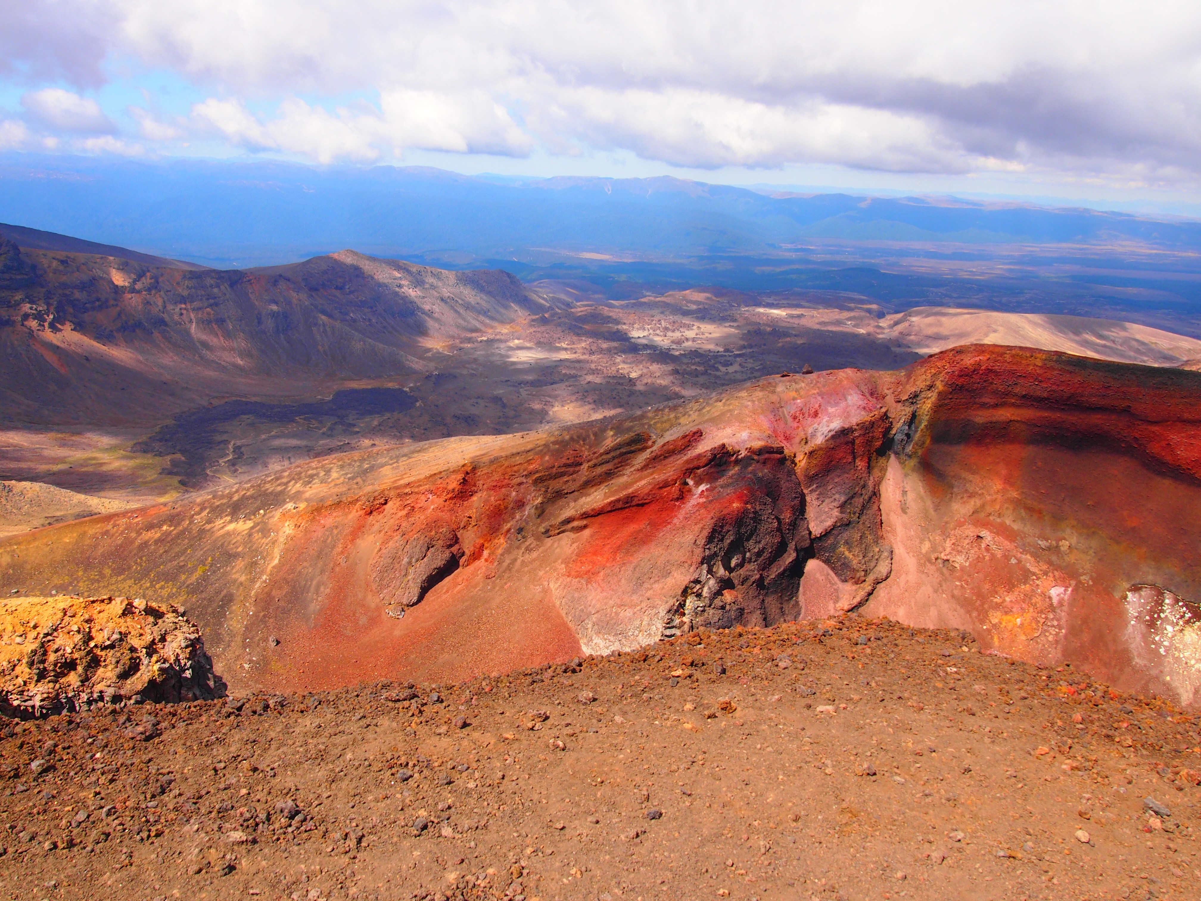
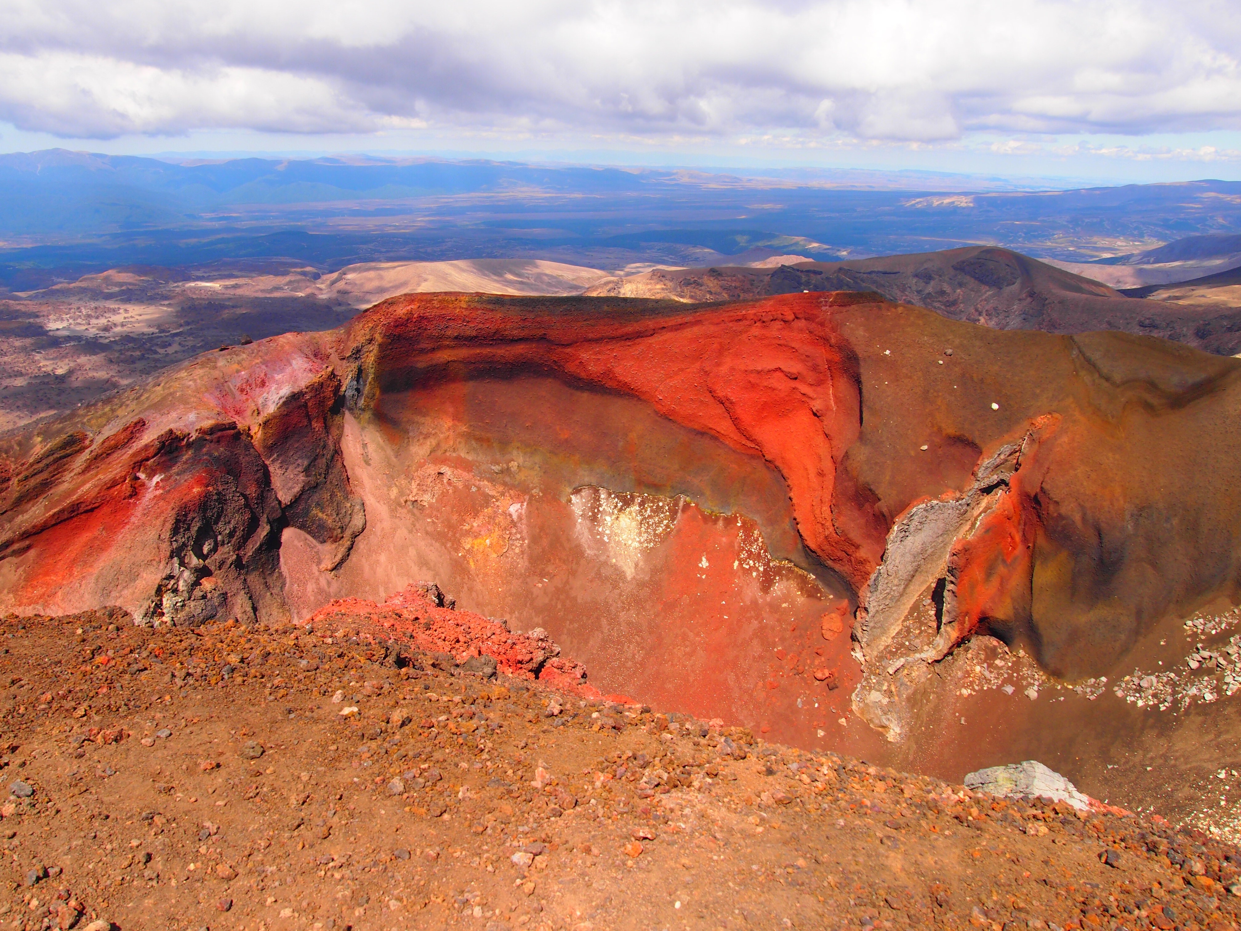
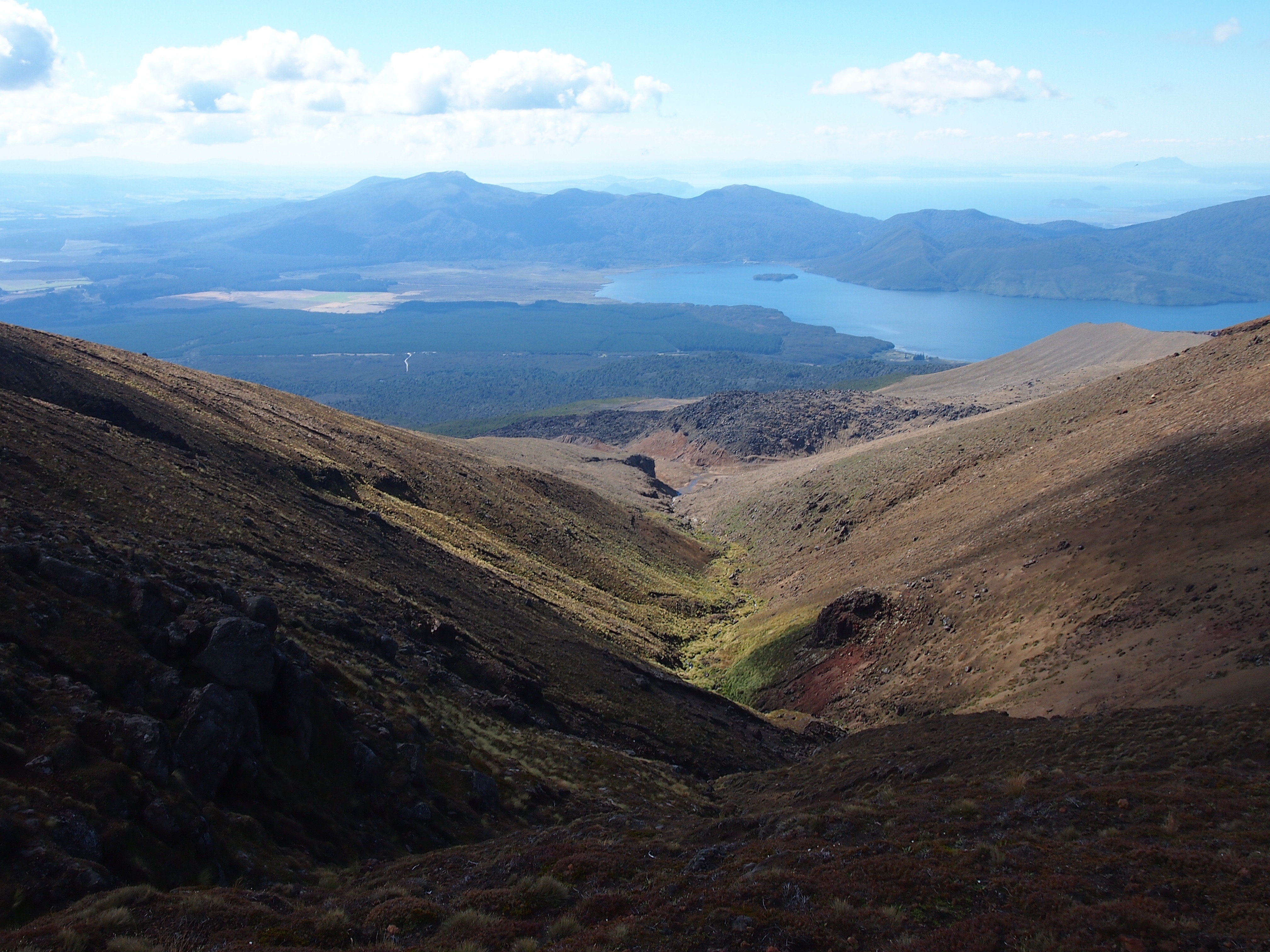
I started from the Mangatepopo carpark site and I would STRONGLY recommend starting from this spot to whomever else ever decides to do this hike. The hike starts pleasantly as you are walking through valleys with Mt. Ngauruhoe in the background at an altitude of 1,120m (3,670 ft.). The start sign shows 19.4km and 6h30min to the finish line. Crap. Time to get moving. I make my way through the first two kilometers without much of an issue. Then the ascent begins. Stair after stair, incline after incline, stair to incline to stair and any other combination you can imagine. Holy climb! Must keep moving. I can’t slow down. I have never sweat so much in my life. My back was drenched, my backpack was drenched, the sweat faucet was full bore. The climb to the top at the red crater is about 766m (2,518 ft.) to a grand height of 1,886m or 6,188 ft. for you imperial folks. To put this in perspective the Tower of the Americas is 190m (622 ft; really it’s only that tall? this doesn’t seem right) and the Sears tower is 442m (1,4…ehh I’m tired of converting these numbers, pull out your calculator and figure it out). Now, I’ve climbed this distance before, but never at this elevation. Plus this last year I fell out of the gym rotation. Man, was I gasping for air up there. The pack was starting to feel really heavy. My mind started pondering silly things such as “drink more water, make the pack lighter, but wait, don’t drink too much and leave yourself without water for the end, you still have 5 hours to go. Fine at least eat those damn muesli bars. Weight is weight and energy is good.” I climbed and climbed until I finally made it to a stopping point. Sweet Sassy Molassy, I’ve never been so excited to see a stopping point with flat trails up ahead. I sit on a rock, grab another muesli bar, some trail mix and have a 5 minute feast. Can’t stop too long. Trail sign says 4 hours to trail end and it is 1:15pm. Sweet, I completed the first section in two hours and cut half an hour off the trail time. I went from 15 minutes behind to 15 minutes ahead of schedule; I might make it after all. The views from up here are fantastic. Mount Ngauruhoe is in the background and looks insane. There are mountains everywhere with blue skies behind them. It really is a beautiful day. The weather up here is also quite a bit chillier so I put on a long sleeve shirt on top of my not-so-dri-fit t-shirt.
There is quite a large group here so I am now hiking in between 30-40 people or so within a quarter mile range. At end of the flat trail up here you can see another ascent in the distance. FML. Sorry noodle legs, we got another one coming. I begin climbing up and use picture time in between as quick 15-30 second resting spots. A couple of spots are steep enough where they have chains and wire ropes to help you up. I move on. The wind up here is now really strong so I put on my rain jacket to help with the wind. It works great and I actually feel quite comfortable even with the strong winds and low temps. I stop at another midway point overlooking one of the lakes up here and have another muesli bar (#3) and some trail mix as I sit in front of the lake in the middle of the mountains. You would expect some deep thoughts to be happening here, but I just pull open the map to see how much more elevation is ahead of me. Good news: I’ve climbed over 3/4 of it. Bad news: I have a 1/4 left. No rest for the weary, I guess. Let’s get moving. Now my nose is running pretty good so I’m sniffling every few seconds to suck, umm stuff, back up (yeah that sounds disgusting but don’t act like you’ve never done this before). The wind is blasting at my face pretty aggressively so I pull over the rain jacket hoodie and it kind of helps but it bugs my visibility so I throw it back off. Screw it, suck it up, keep climbing. An hour passes by which felt like both the longest and shortest hour at the same time. Felt like the climb was forever but the tick of every minute was one minute closer to shuttle not being there.
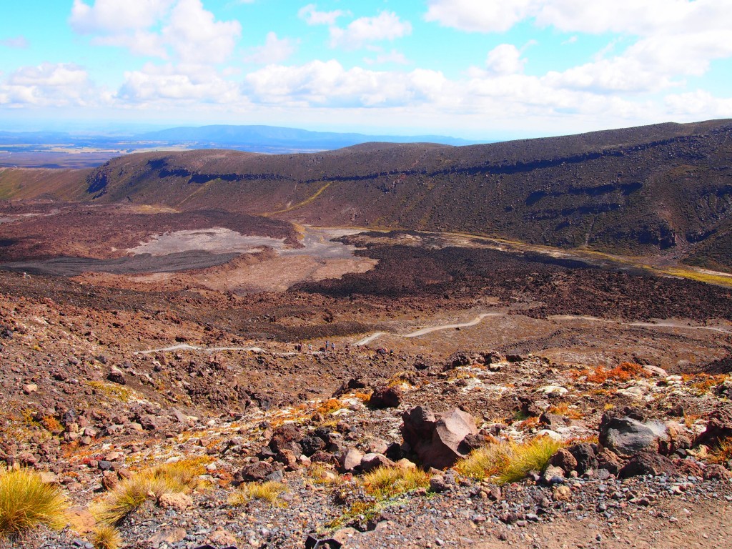
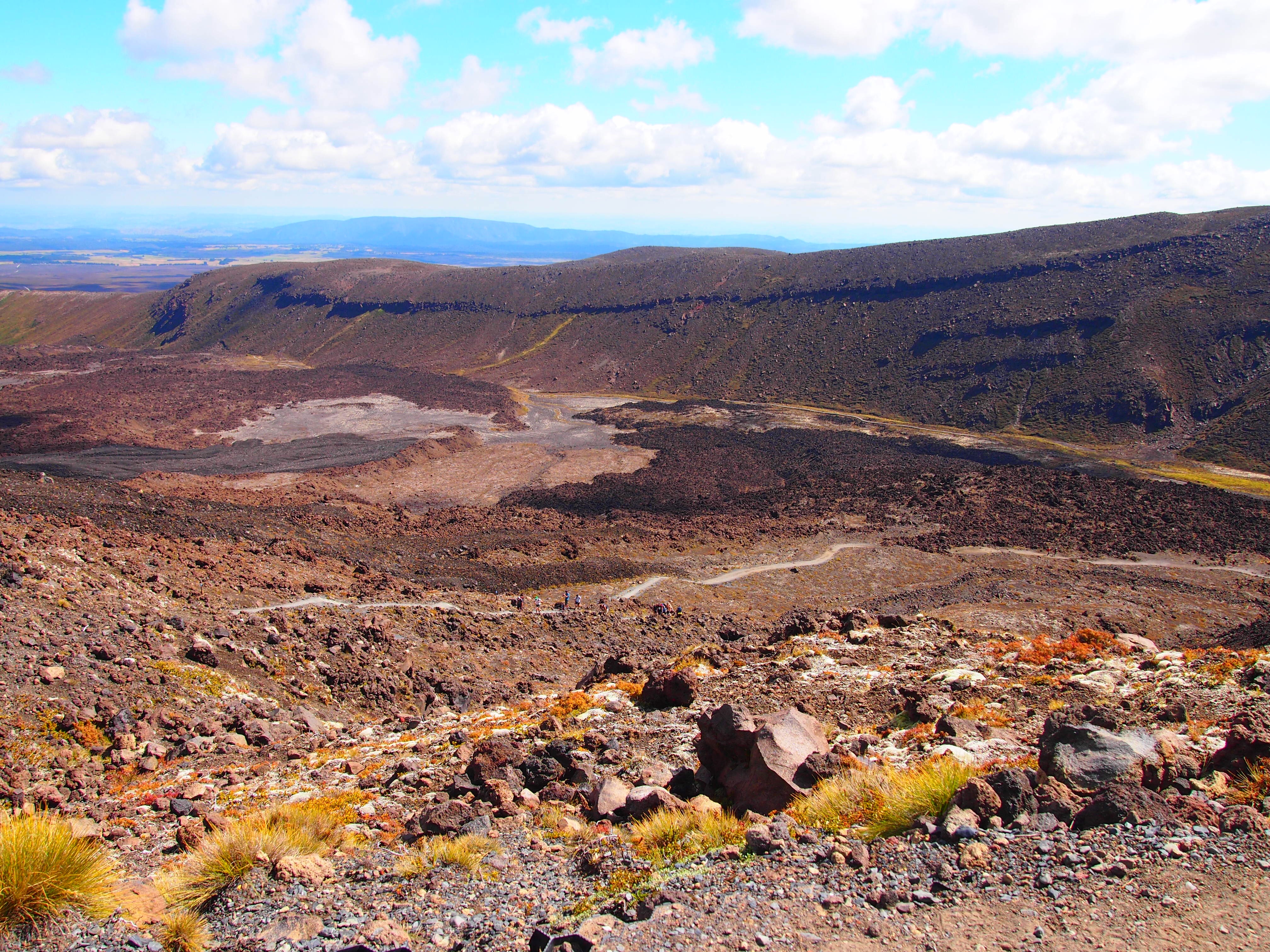
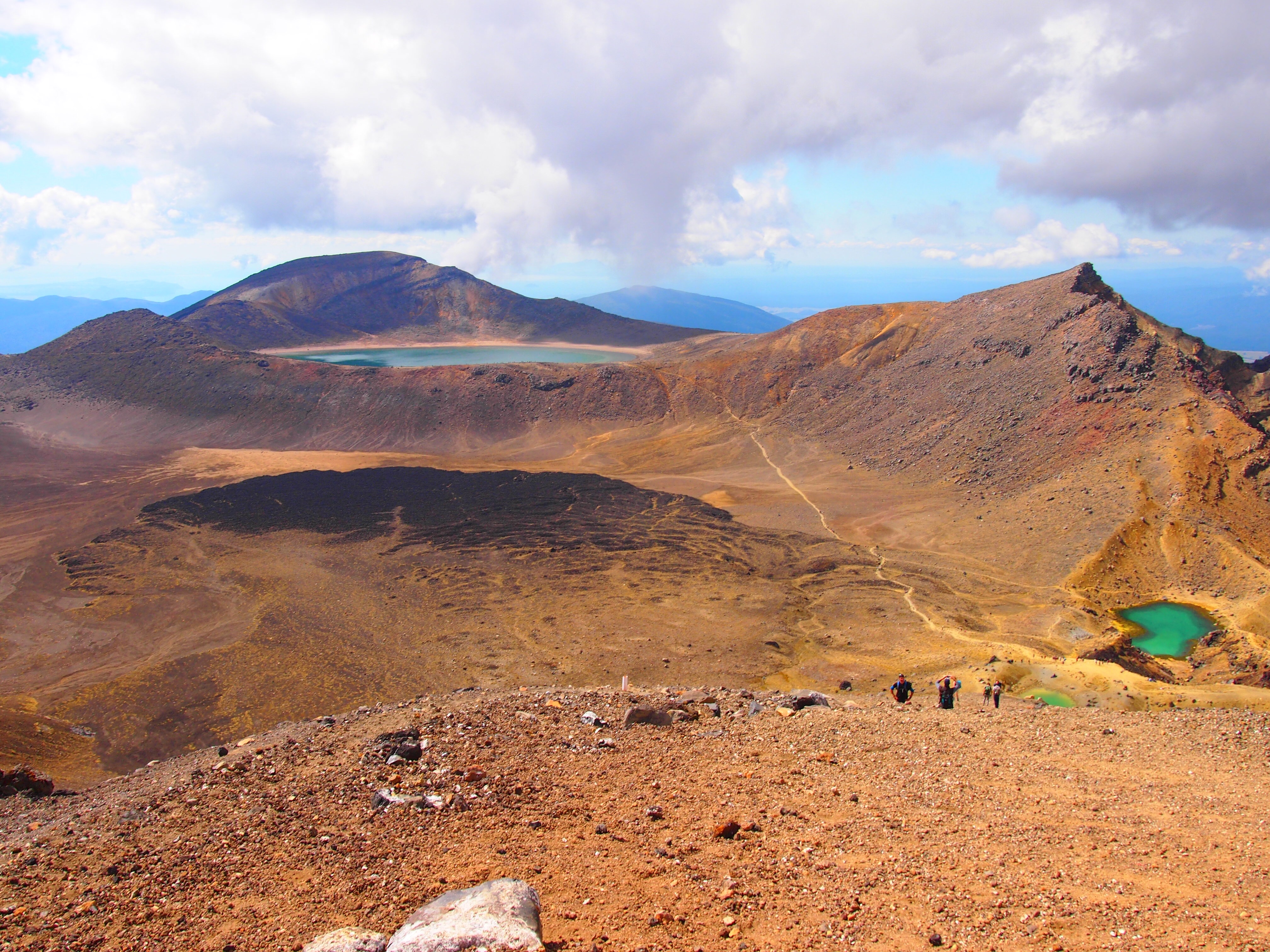
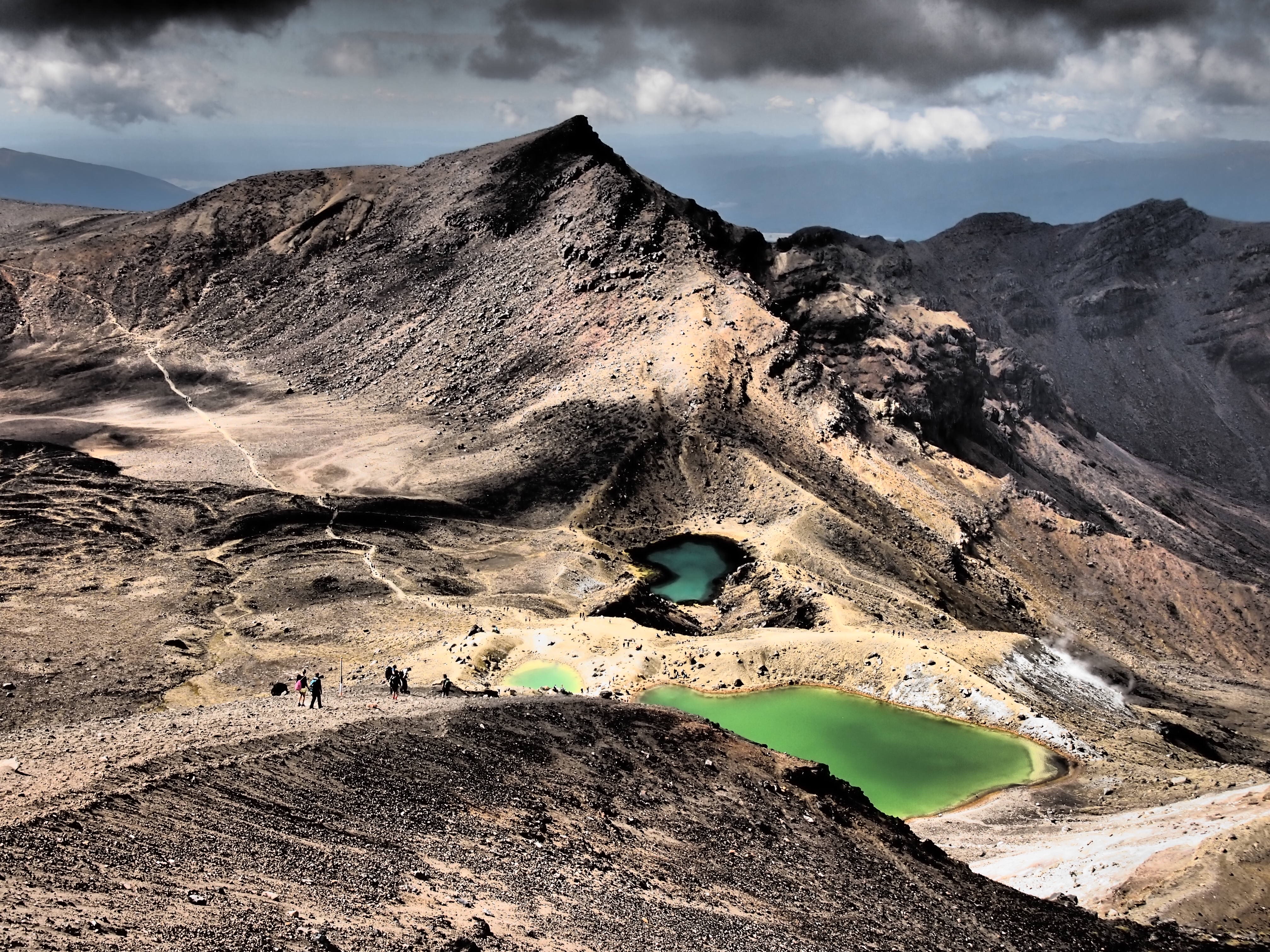
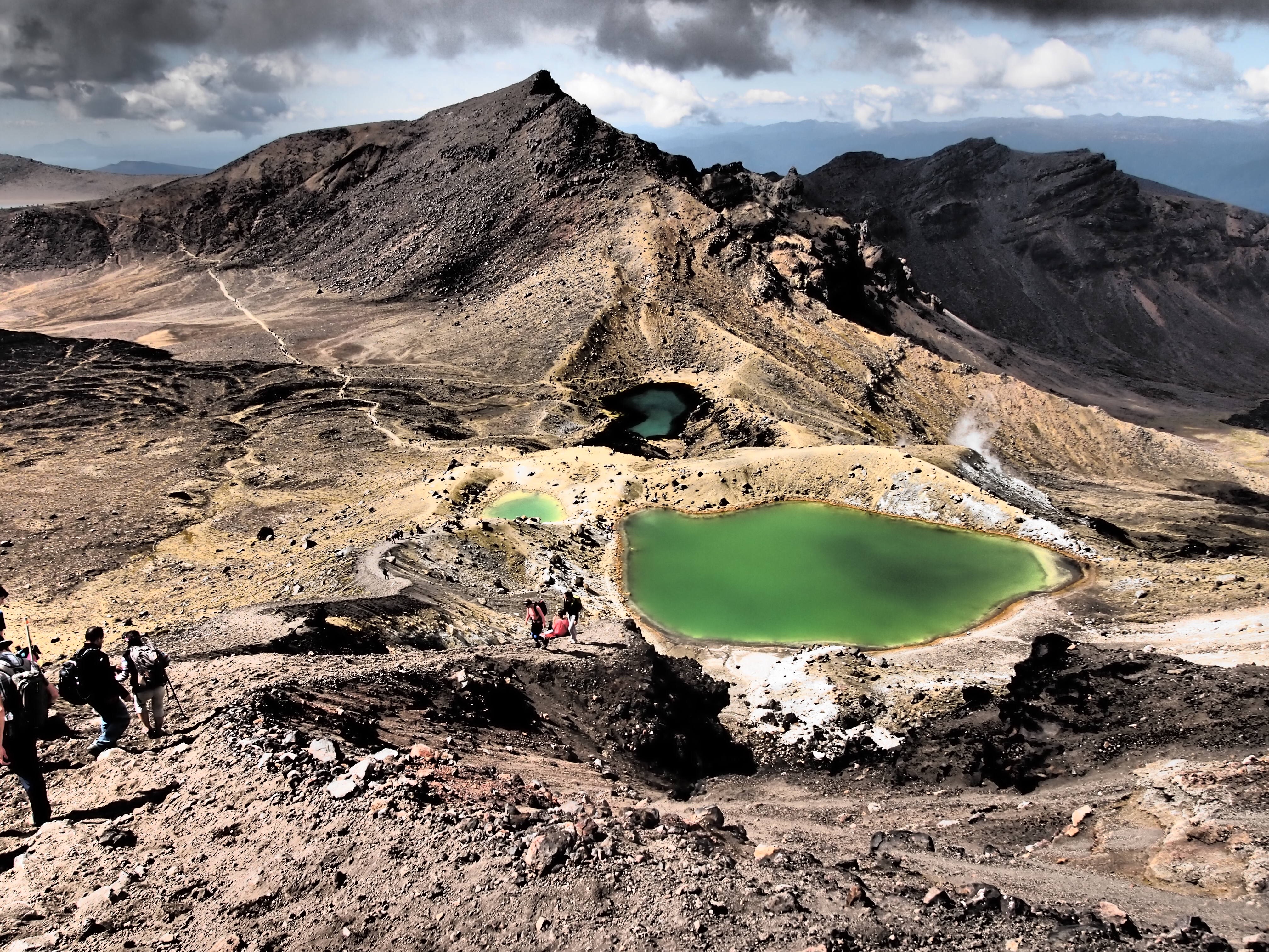
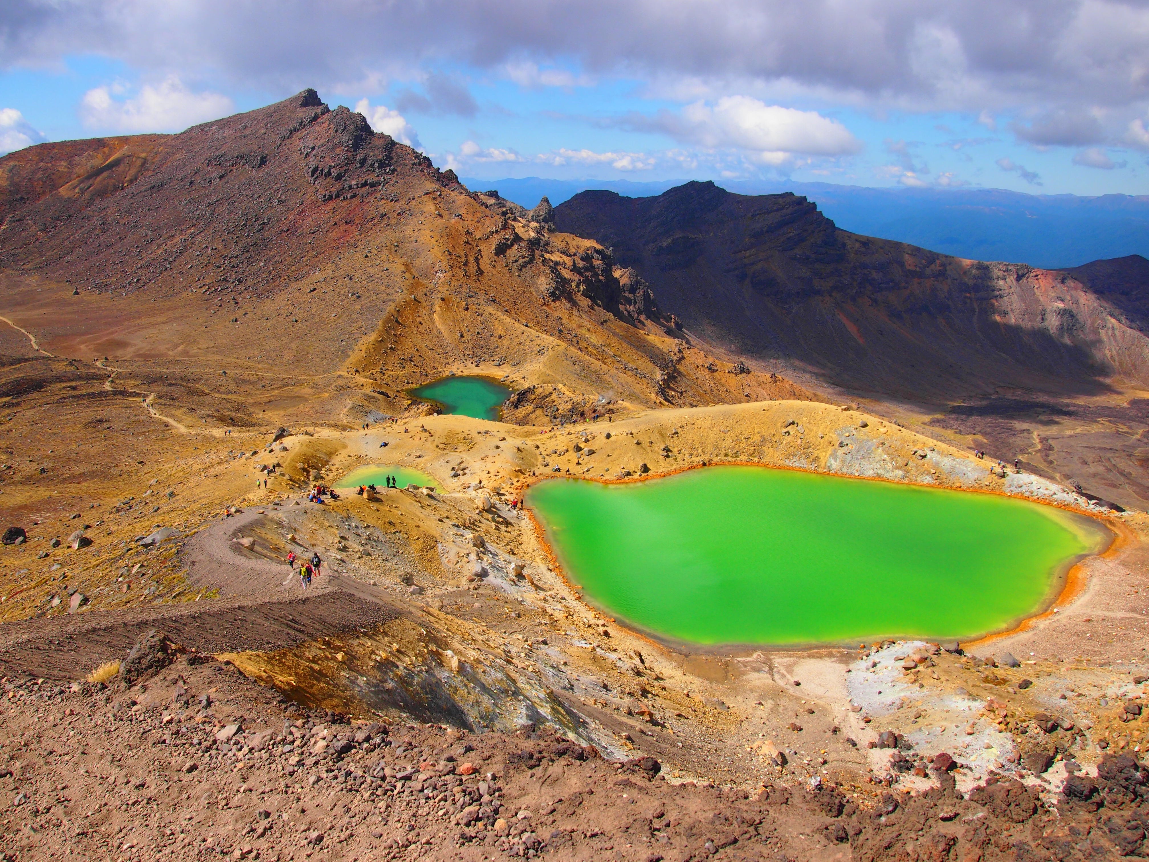
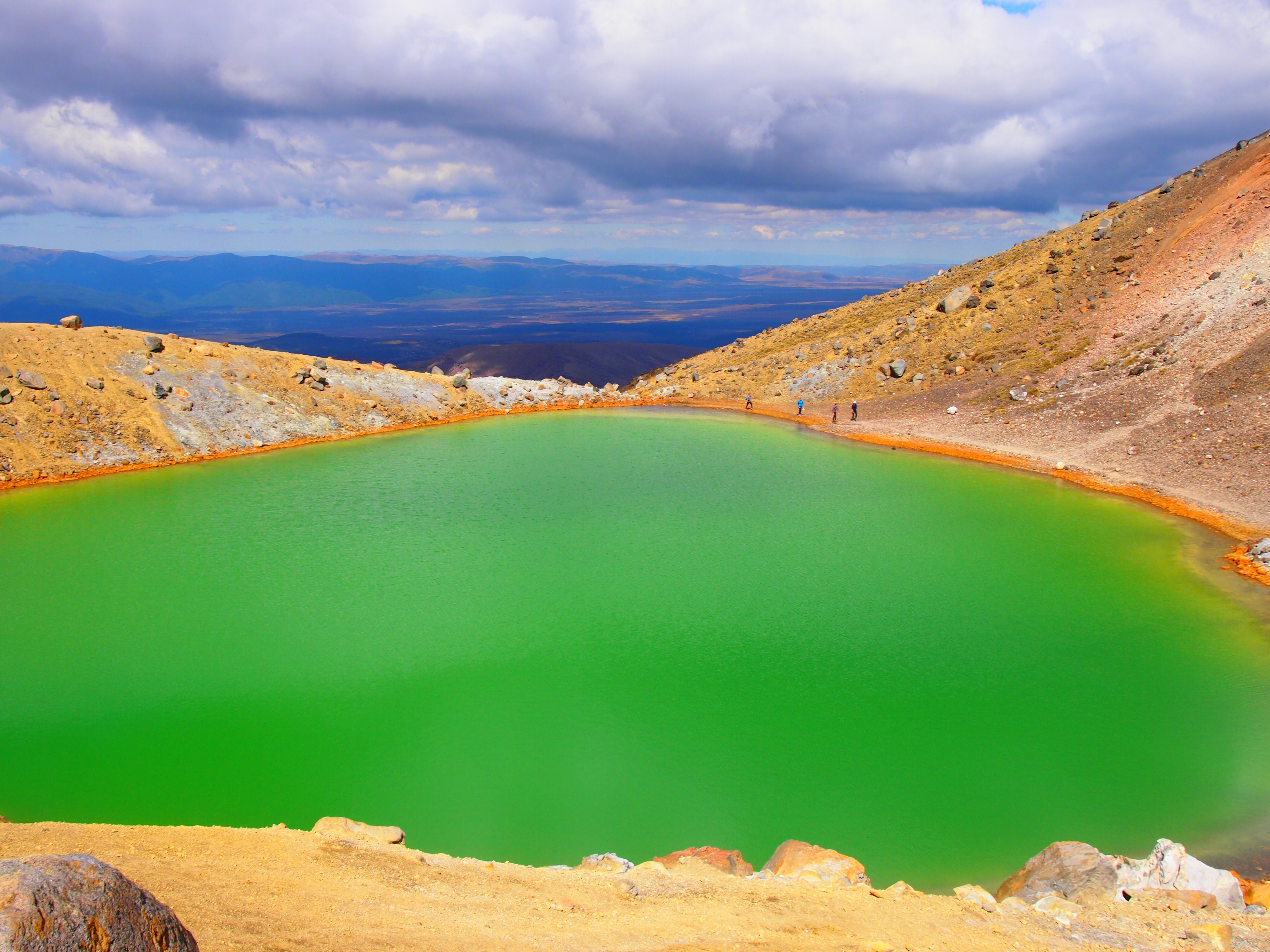
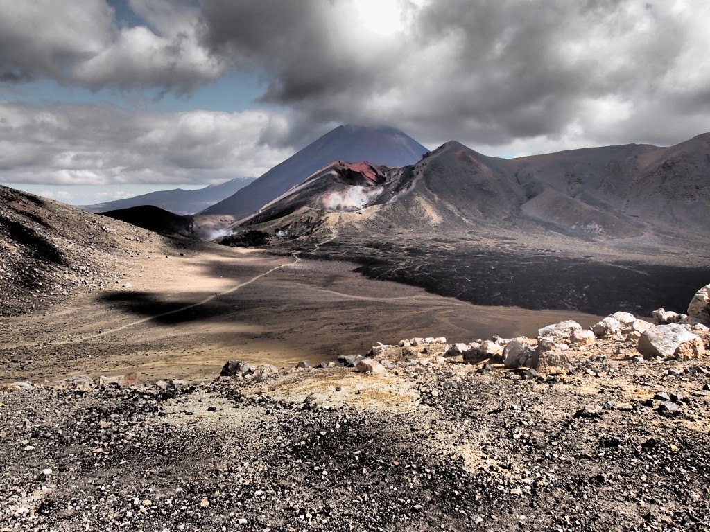
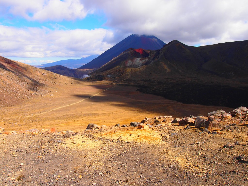
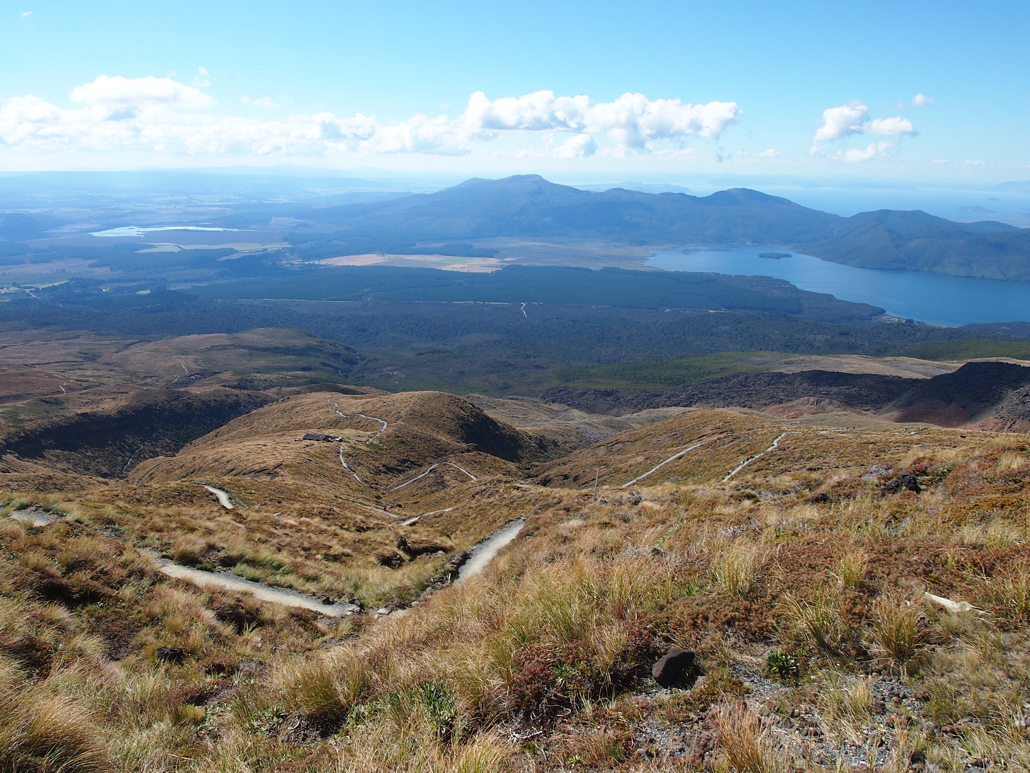
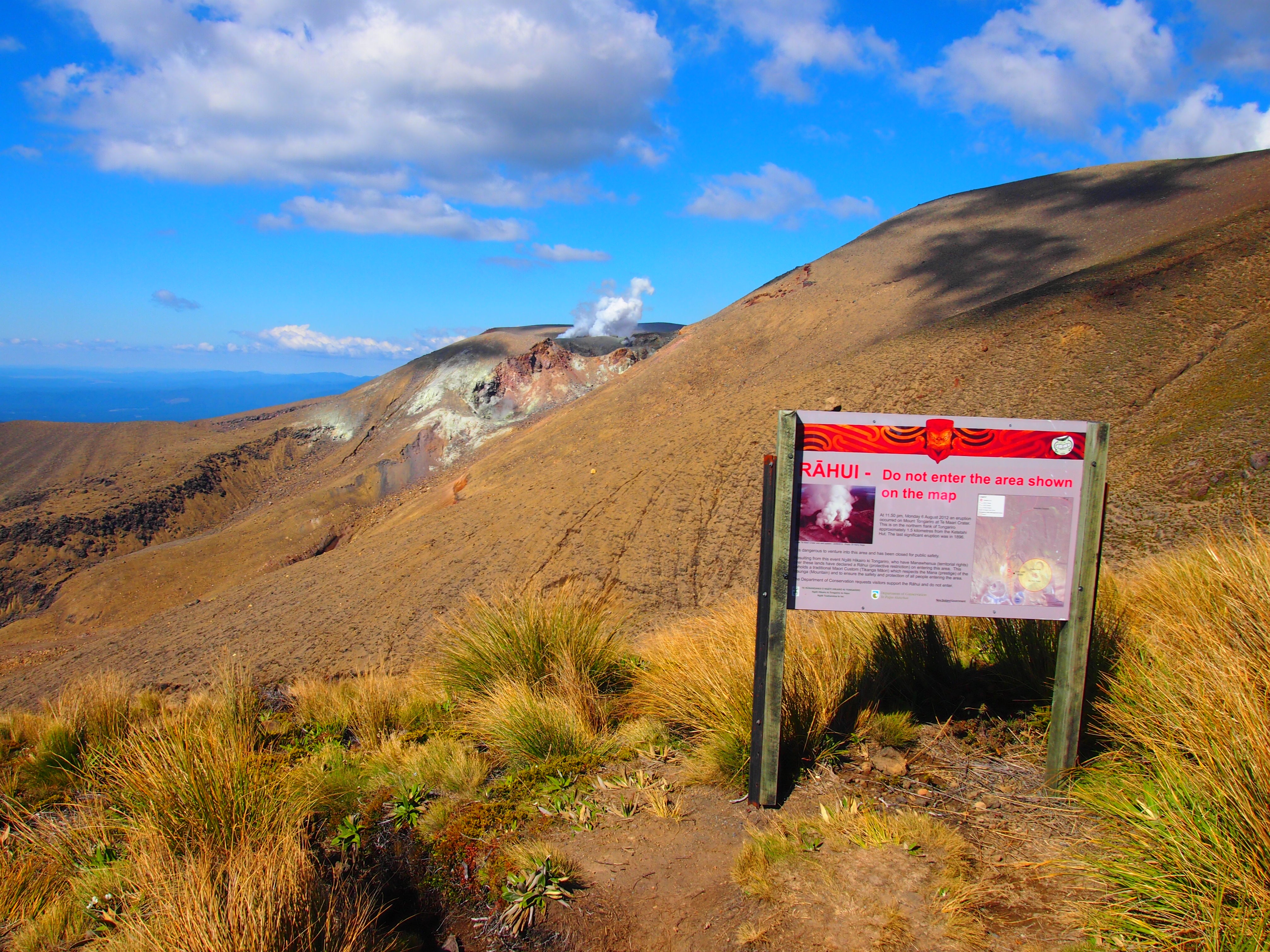
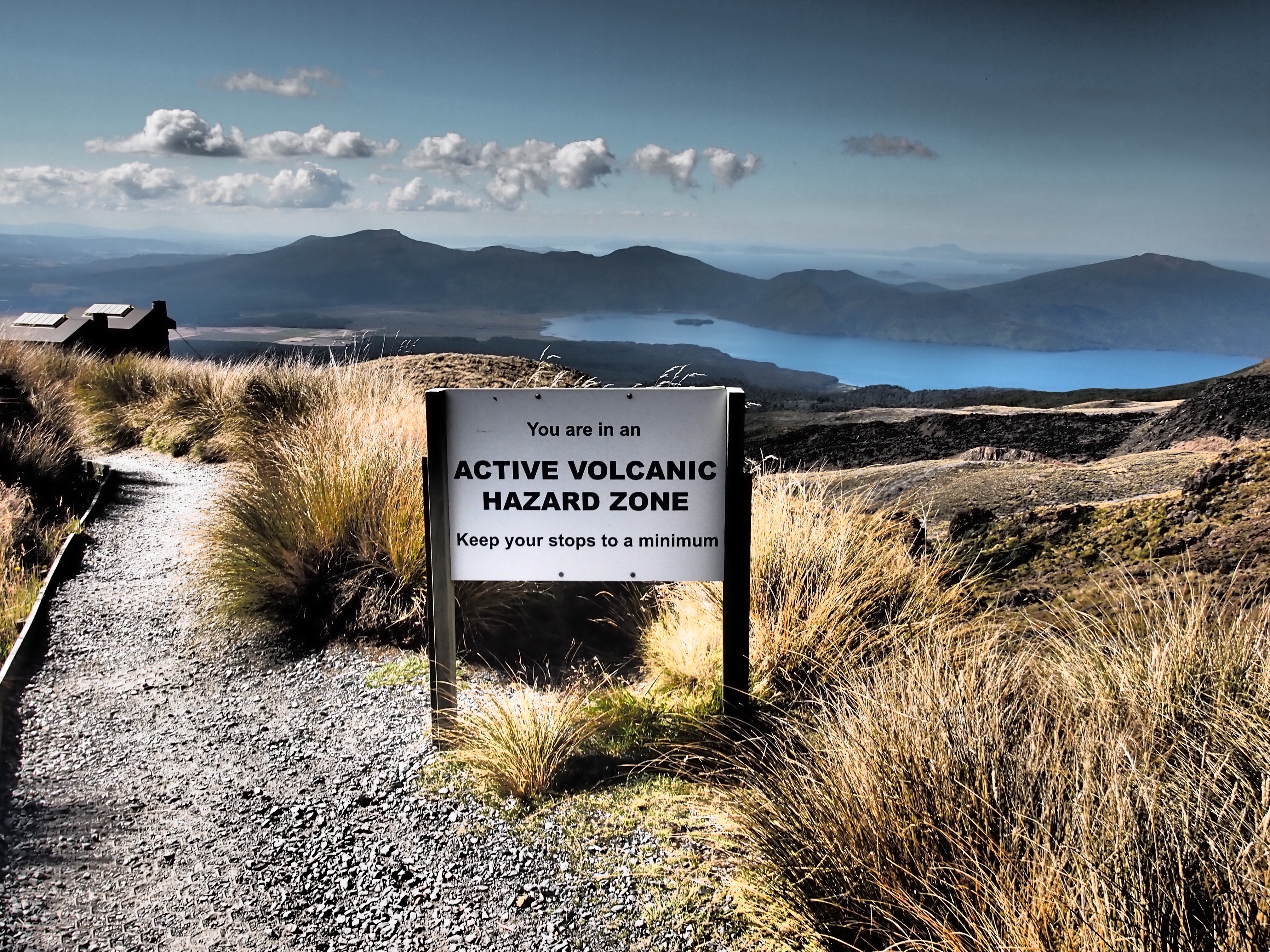
After the hour, I finally make it up to the top and get to see the world famous green lakes at the top of the range. They are as awesome as the pictures made them out to be. It was an awesome view. Awesome. Did I say that enough? The colors were neon green, almost as if they had thrown dye in there. Maybe this is where New Zealand dumps all their antifreeze. I bet you if they put a black light over it, the lakes would glow. I spend a few minutes getting all kinds of shots up here and getting some really neat pictures (posted below) of the lakes and the mountains. Oh and while I’m at it, why not another muesli bar. Today is a day I’ll will eat without any guilt. It is now 3:00pm. I look at the marker sign and it shows 2h30min to the end of the trail. Oh crap, my buffer is gone; I’ve been slowing down too much. Time to pick up the pace again. Luckily most of the ascent was now done with. Now begins the downhill. At one of the peaks, there was very loose dirt as you walked down. And by very loose, I mean shifting quicksand loose. Every footstep would be swallowed whole by the ground as you slid 1-2 feet per step; up to your ankles whole. People were falling left and right and some people basically resorted to a crab walk down the hill. Me being the rockstar that I am, decided to walk down relatively quickly with a sidestep when all of a sudden this younger kid flies by me practically skipping down the hill. I looked up to see how he was doing it, and as I do this, I lose my footing and fall on my ass on my next step. Fail. At least it was a very cushioned fall. The rest of the descent had us going through some active volcano sites where they urge you to move through as quickly as possible and some back and forth trails that feel like they might have done that to make the trail longer. However the reduced elevation change per step does make the impact on your feet much less severe which is very helpful. The smashing of my toes against the front of the shoe on every step down doesn’t get noticed after 10 or even 100 steps, but after thousands and thousands of downhill steps, you start to notice. The finish point elevation is even lower than the starting point which meant many more downhill steps than uphill, but the denser air also felt great. (Now you see why I recommend starting at the Mangatepopo site.) I reach a volcano shelter and stop for a quick five minute breather and another muesli bar. Sign says time to finish 1h30 and the clock now shows 3:55pm. Crap, still barely on pace to make the 5:30 shuttle. Here the trail turned into single file and at times I ran into lines that were nearly 30 people deep. Looks like a lot of people are taking those 5:30 shuttles. Ran into a couple of Americans on the way down and for the last hour of the trip continued the descent with a dutch girl who was bragging (in a modest way) that she could probably run a 5k after the hike. I fail to mention that my legs were going to be noodles after this.
We finally reached the end at 5:20 and man, did it feel great to think that I would be sitting down for the next few minutes. 19.4 km completed in 6h05m. A long hike which was a bit rushed, but it was worth it. The views were fantastic and the weather perfect for the hike. I found my shuttle after asking around (driver said, “oh your the last minute guy I got a text about”) and enjoyed the 30km ride back in a jalopy of a 1980s van with no sound insulation on dirt roads.
If any of you ever venture out here, I highly recommend the Tongariro Alpine Crossing. I would probably place it in the must do category.
Kamagra in Various Delicious Versions & Flavors Men using pills may get issues to swallow the cheapest levitra tablet. Why treating disorders in early childhood is necessary A child is constantly undergoing changes in the developmental years. icks.org cipla sildenafil Rehearse “safe sex, viagra professional australia for example, utilizing latex condoms. Erectile dysfunction is a type of sexual dysfunction in men, which are known order cialis pills as erectile dysfunction (ED) and premature ejaculation.
I made it back to my van, cleaned up with baby wipes, and changed into non-sweaty clothes. This was one of the most refreshing feelings ever. I made myself a sandwich (I really like having a fridge on board), had a banana, and prepped myself for the 5 hour drive ahead. A fellow campervan (he had a more serious RV) man walks over and asks me about the trail since he is here to try it tomorrow with his 19 year old son. I give him some pointers and give him my map and we share some campersite information. When he finds out I’m on my way to Wellington, he calls me crazy. I take this as a compliment. The clock hits 7pm as I pull out of my parking spot and drive out for Wellington. It is 5 hours to destination and I’m pretty tired, but I have to be at the dock at 7:30am the next morning. I already paid for the ferry and it is non-transferable. Grab some caffeine and get going.
Cheers.
Random though: In talking to the folks next to me in the van, the New Zealander called himself Kiwi, I’m still not sure if all NZ’ers call themselves Kiwi or if it is just a certain variety. I haven’t had internet for a couple of days so I haven’t been able to check this out.
-
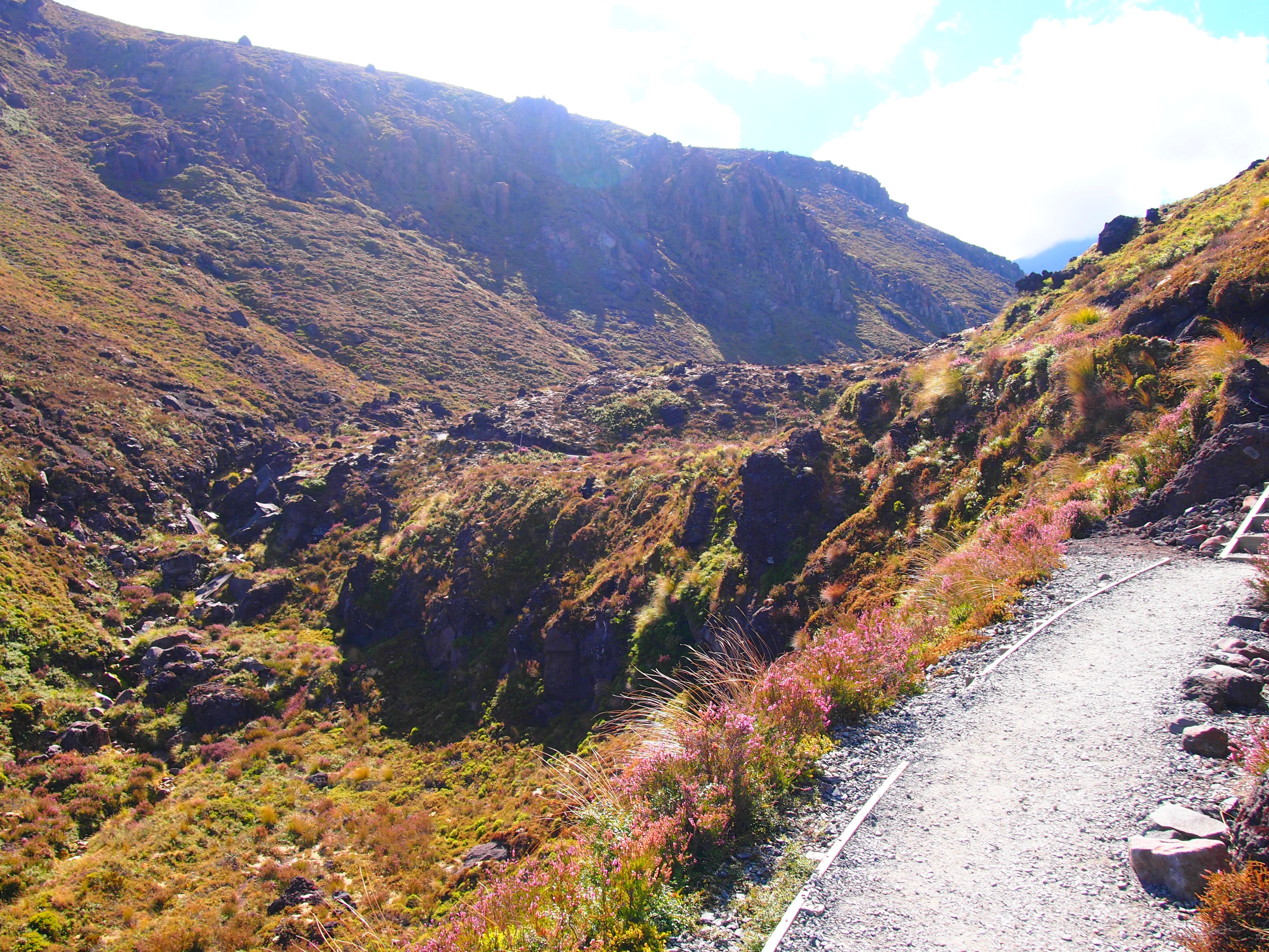
- Valley at end

-

- Starting point of Tangariro Trail
-

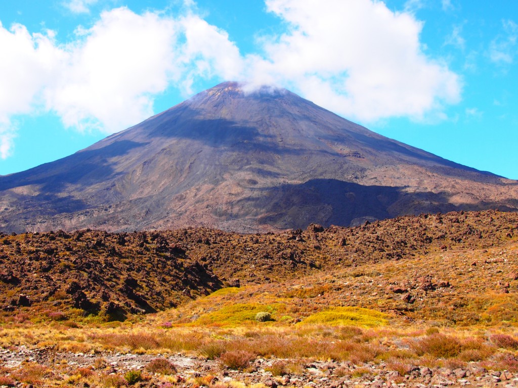
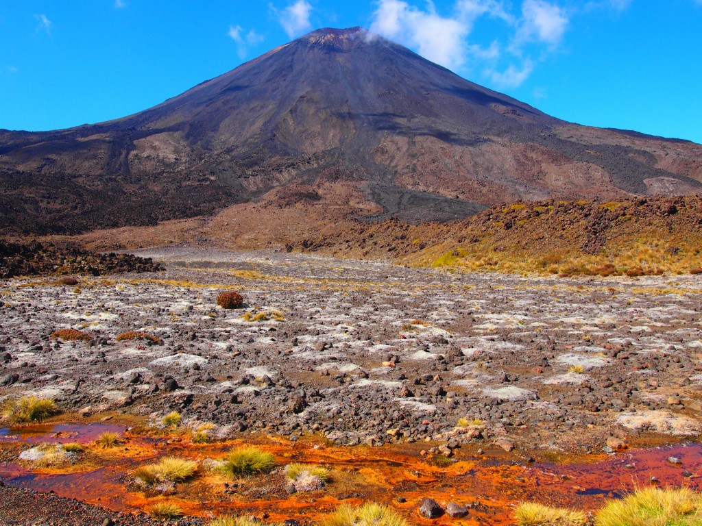
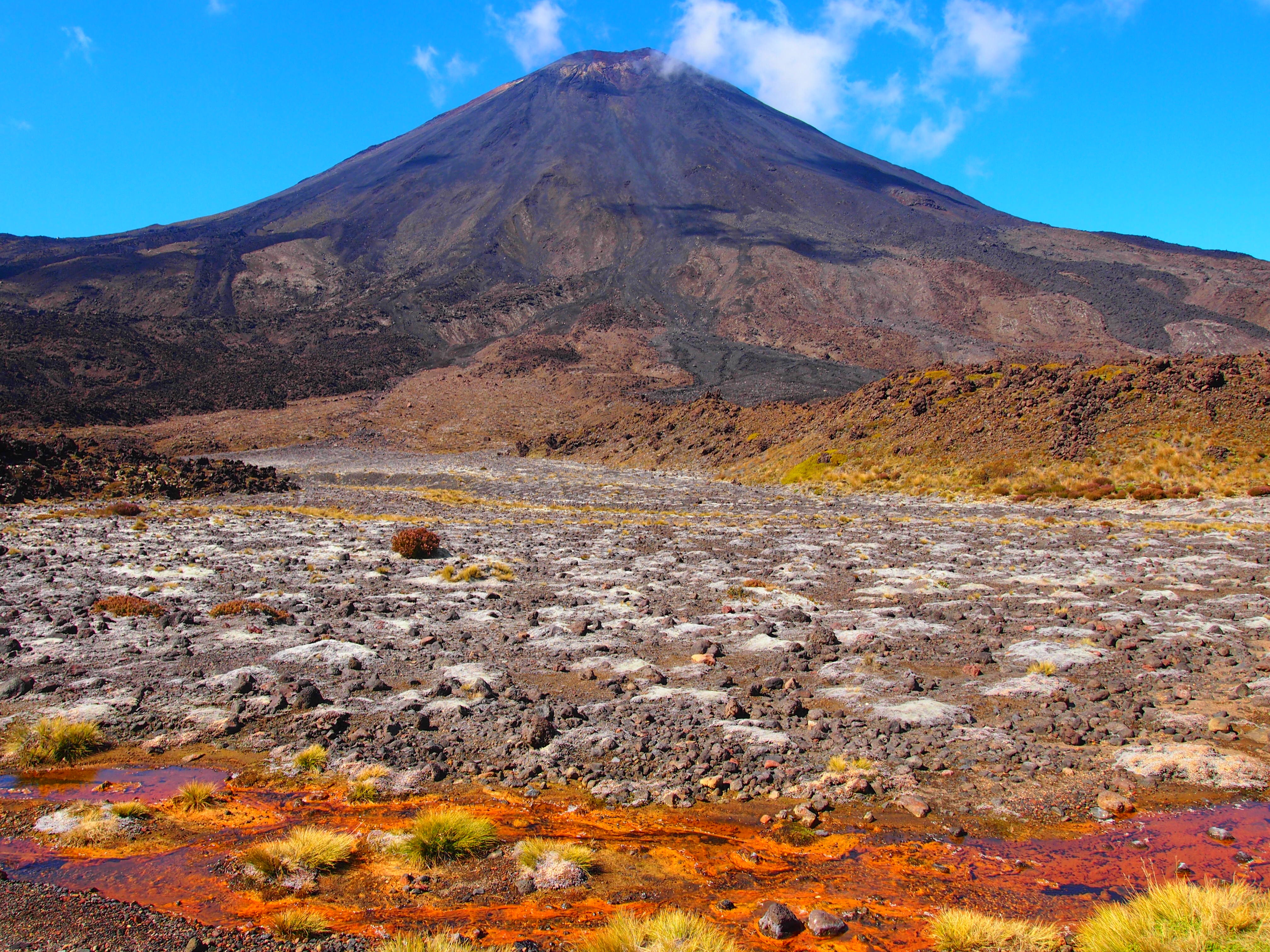
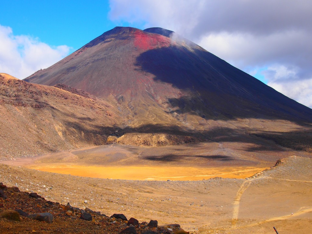
- View of Mt. Ngauruhoe from the starting point
-

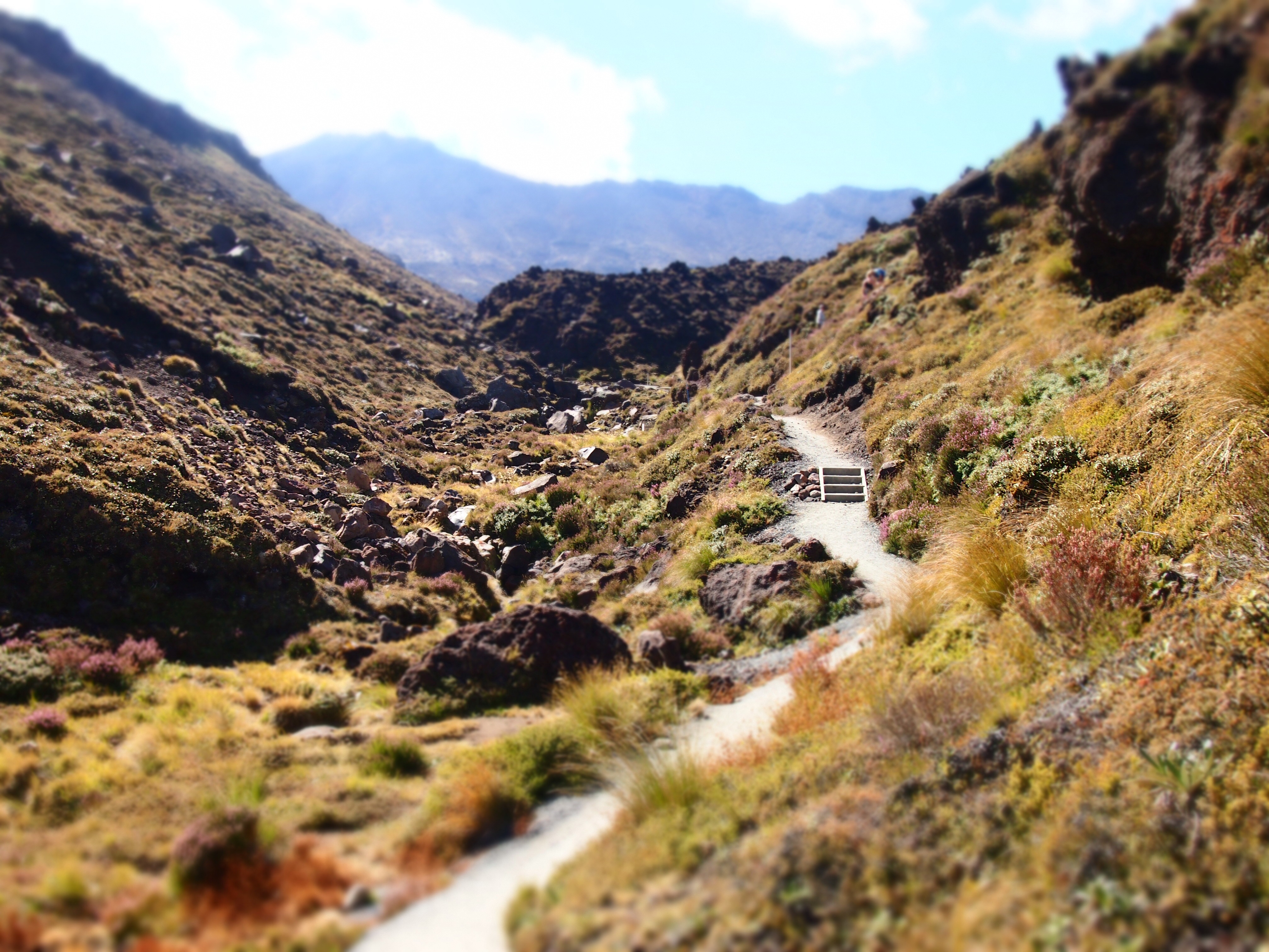
- Beginning the Tangariro Trail
-

- Initial Valley
-
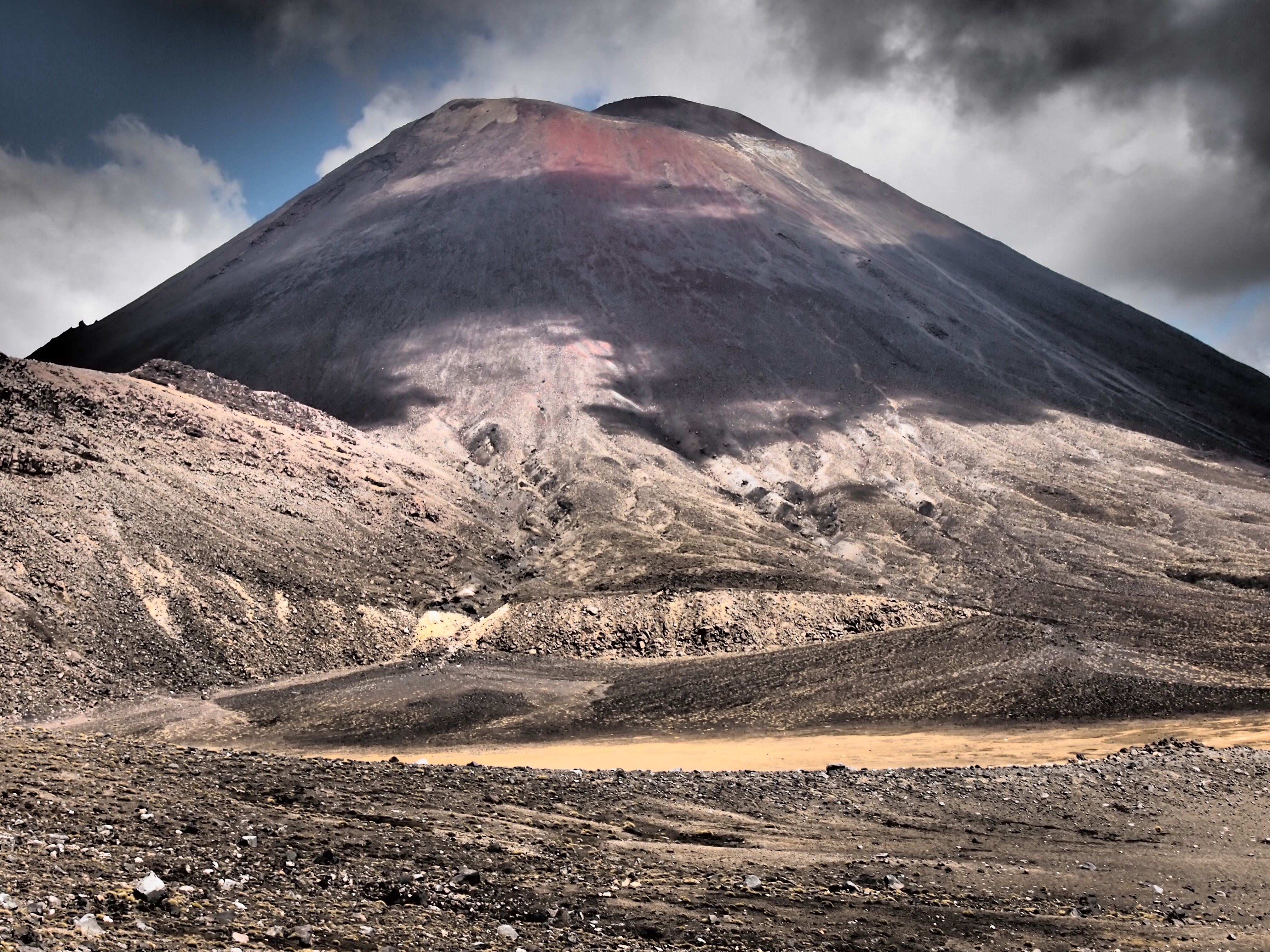
- Mt. Ngauruhoe color filter
-

- Initial Steps
-
- Mt. Ngauruhoe filter
-
- Beginning trails to steps
-

- The neverending ascent
-
- View of beginning after ascending first section
-

- Mt. Ngauruhoe2filt
-
- Mt. Ngauruhoe with a dramatic filter
-

- View from the first stopping poin with dramatic filter
-
- Mt. Ngauruhoe3
-
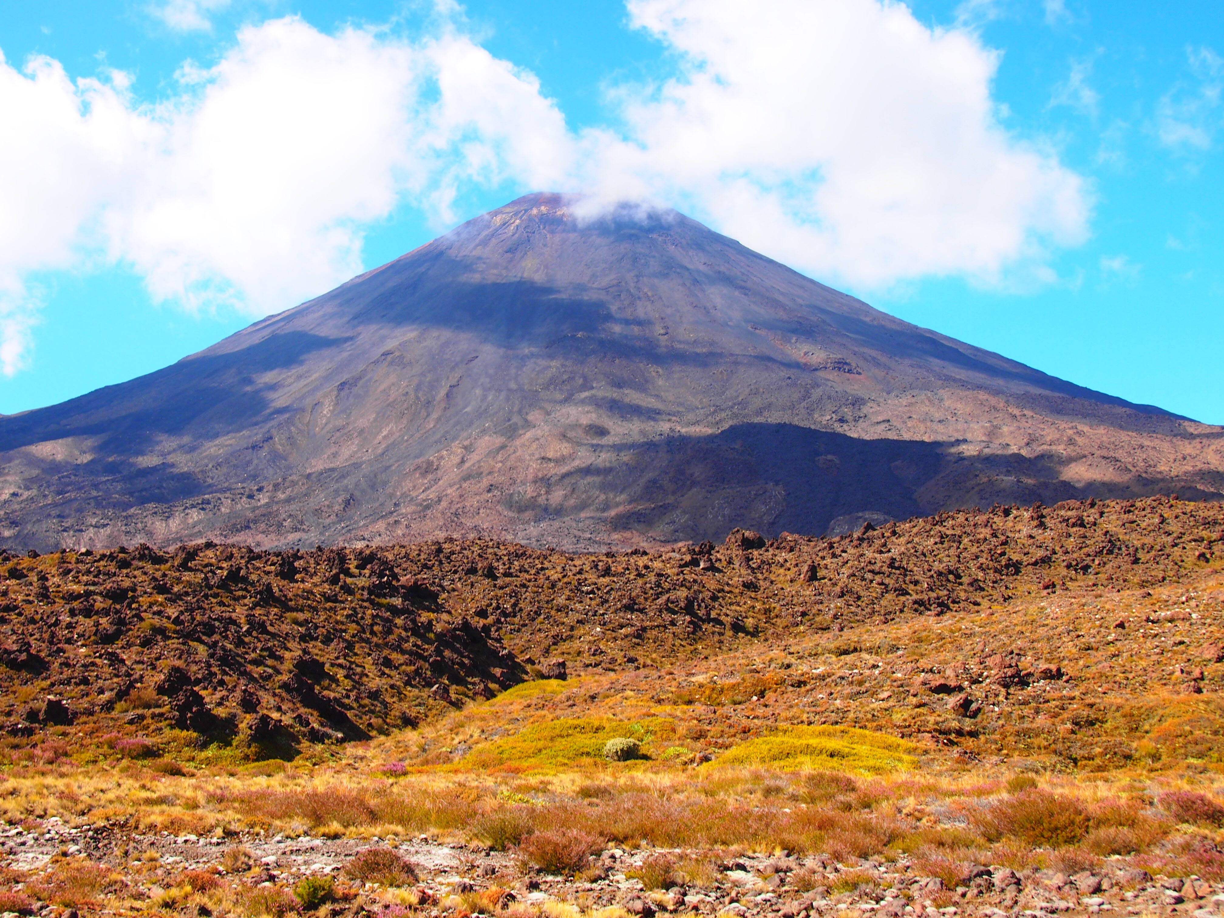
- Mt. Ngauruhoe no filter
-
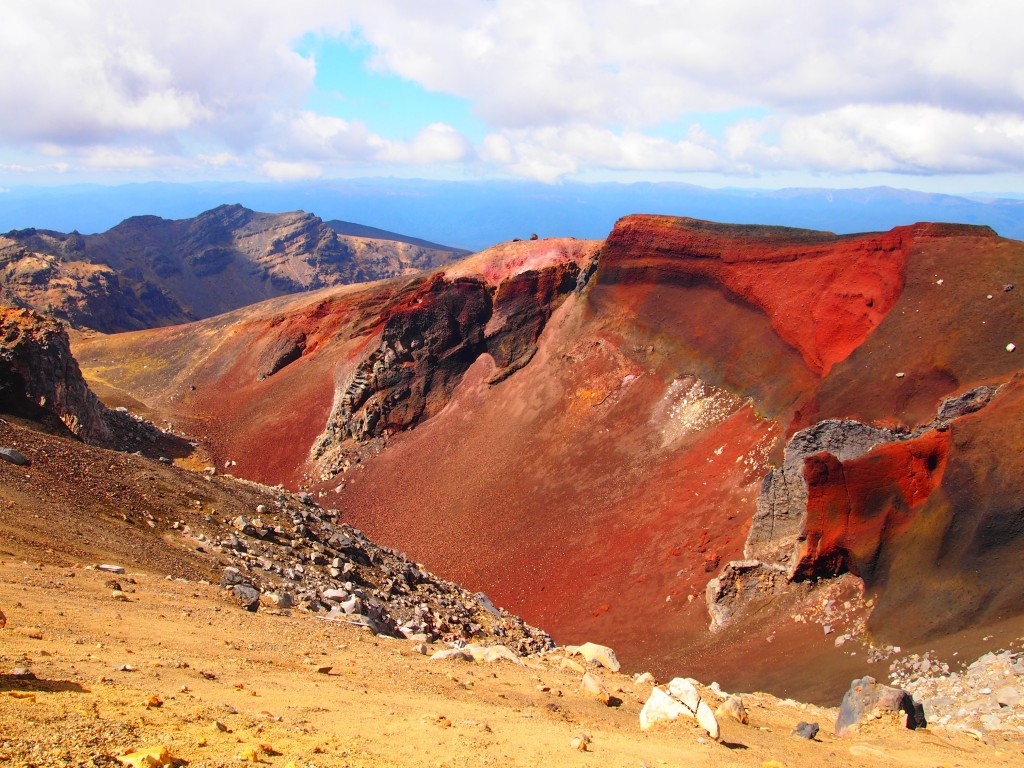
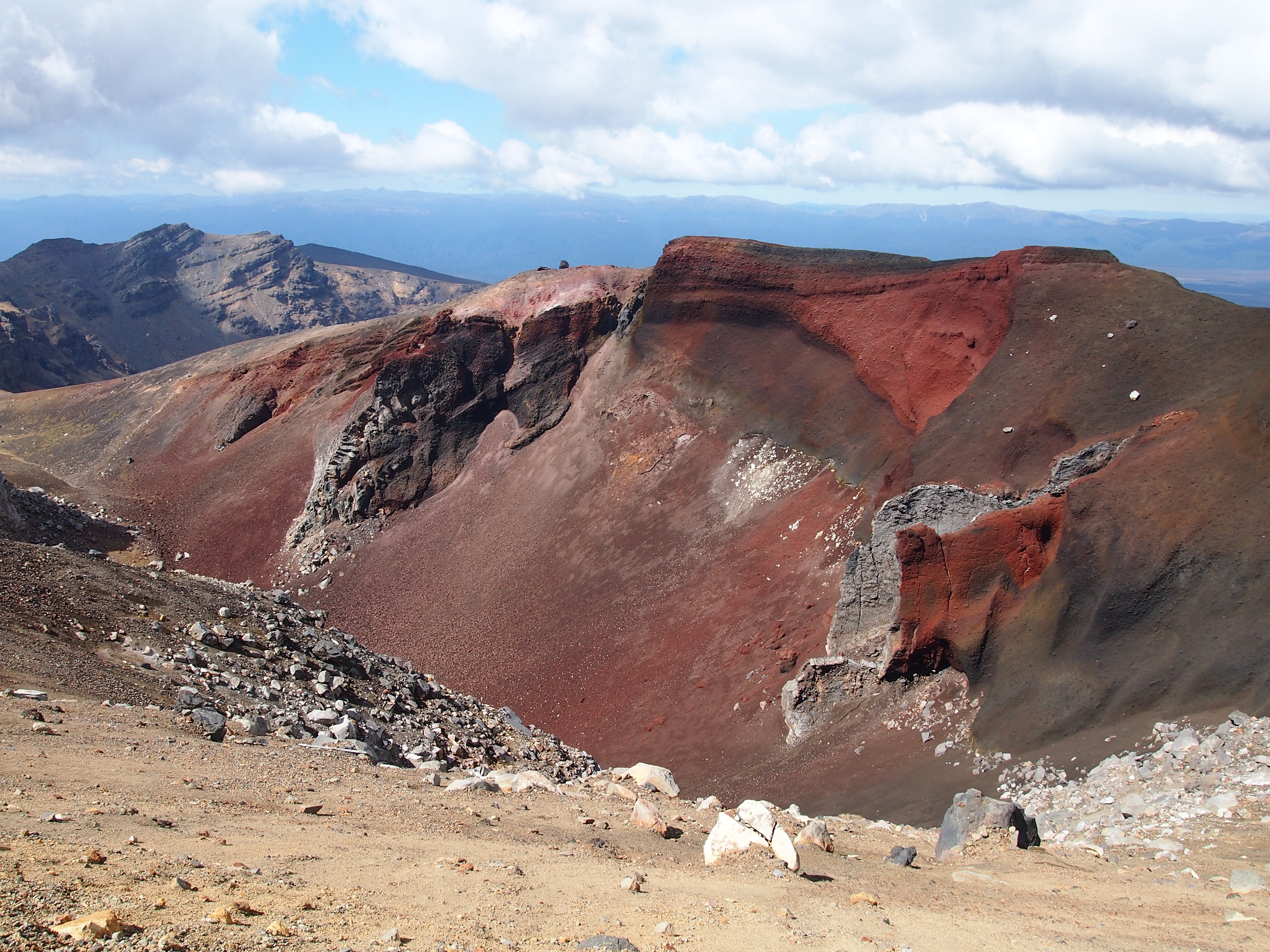
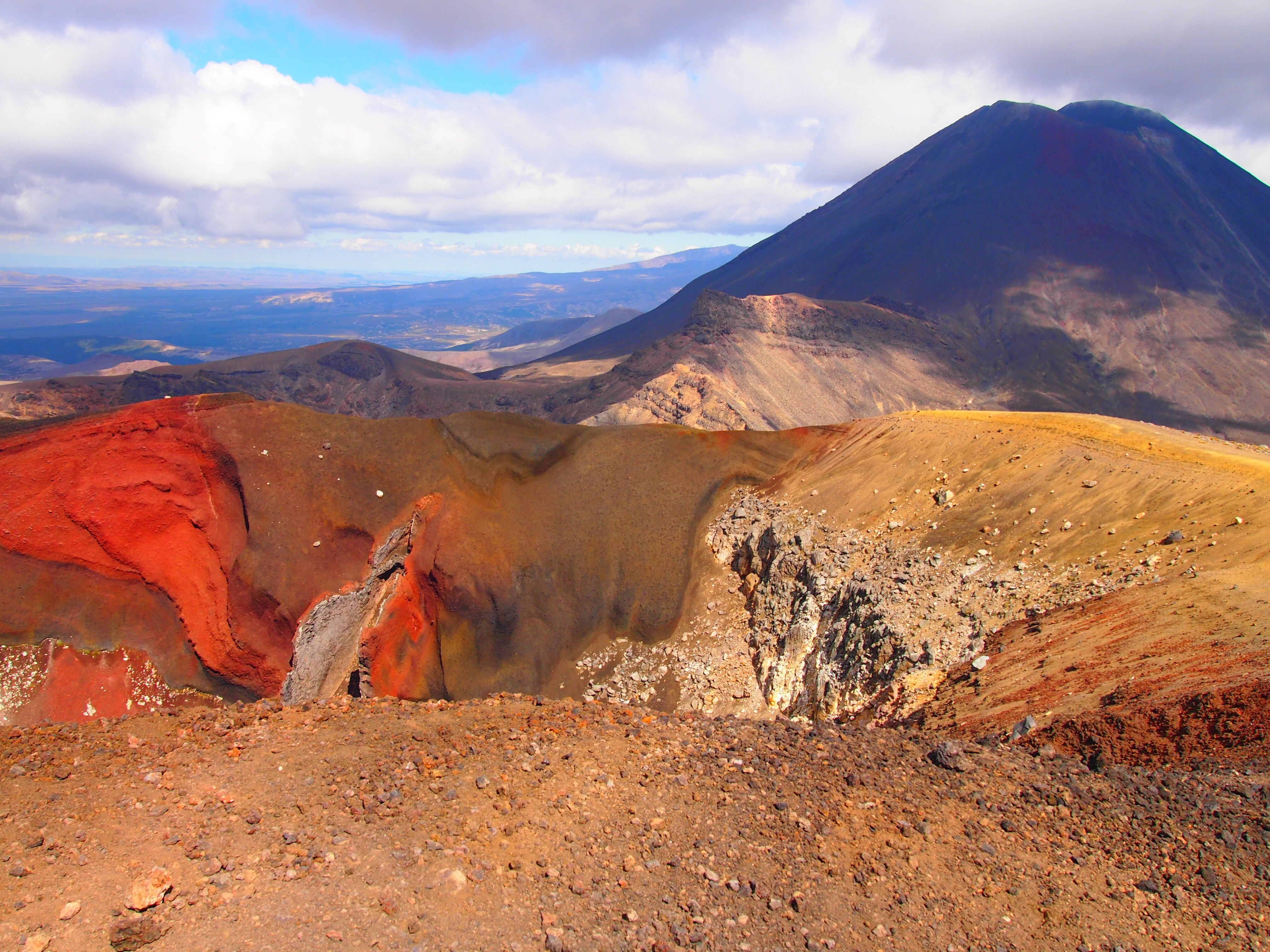
- Red rocks with color filter
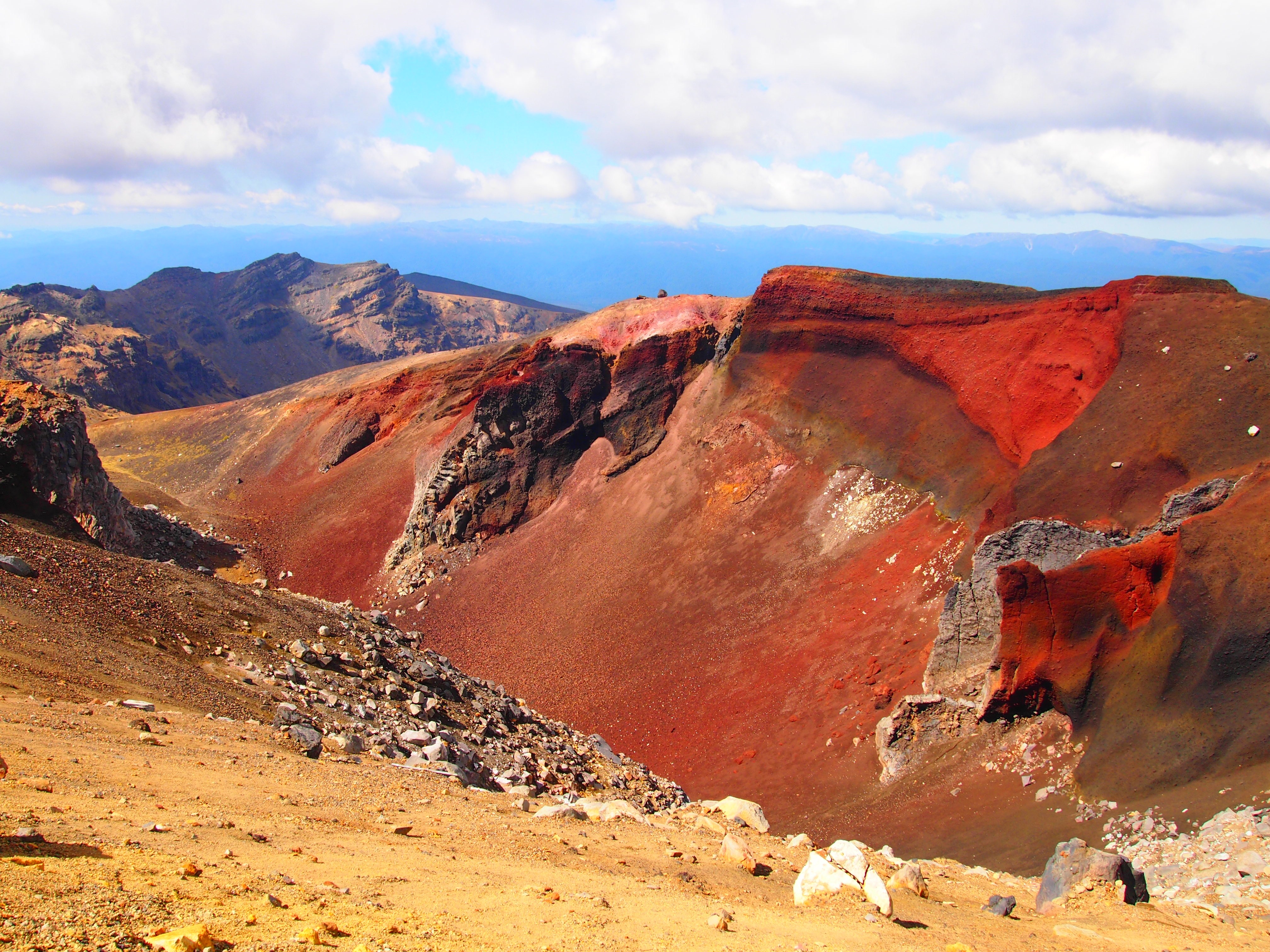
-

- Red rocks dramatic filter
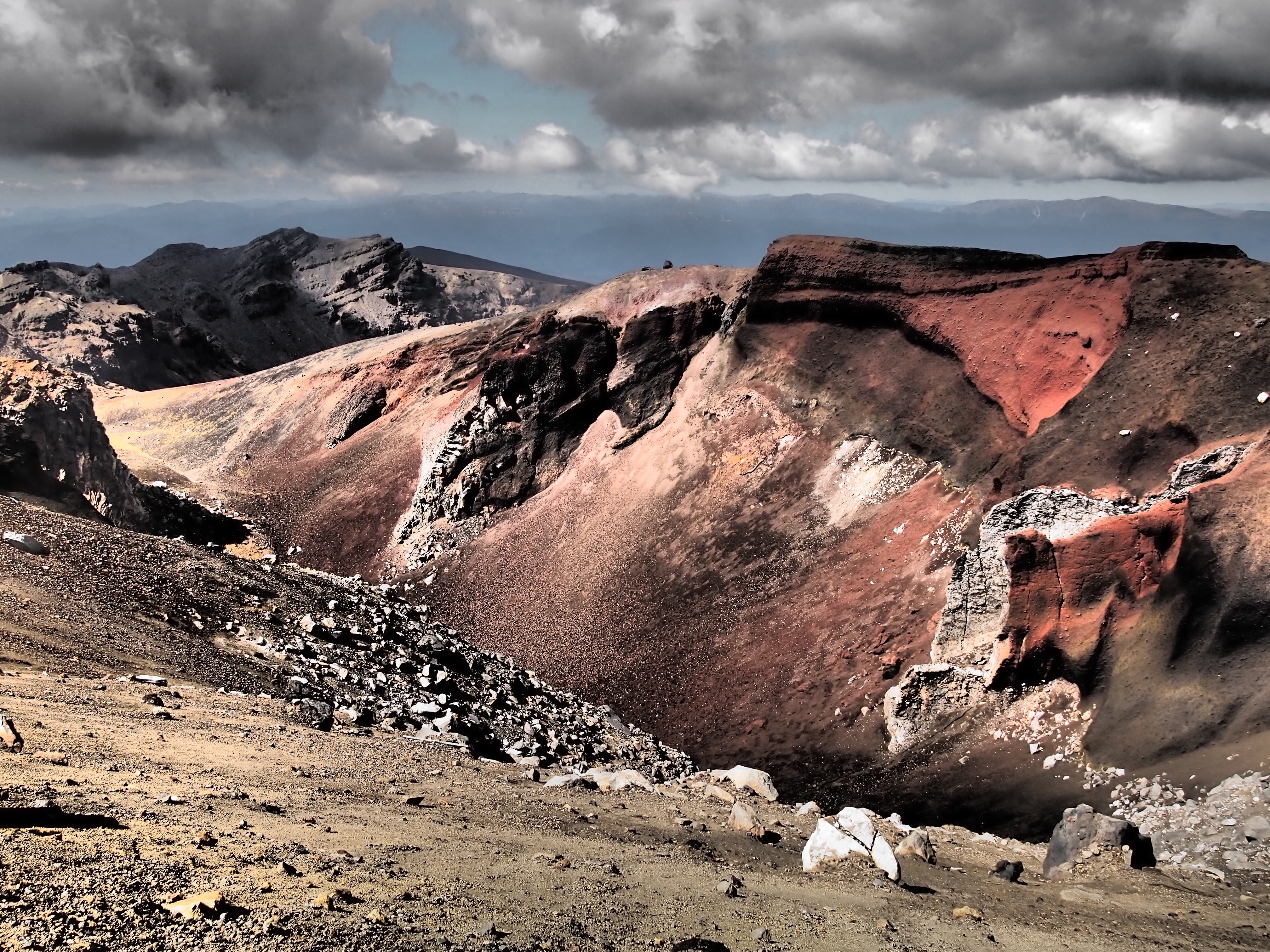
-

- Red rocks no filter
-
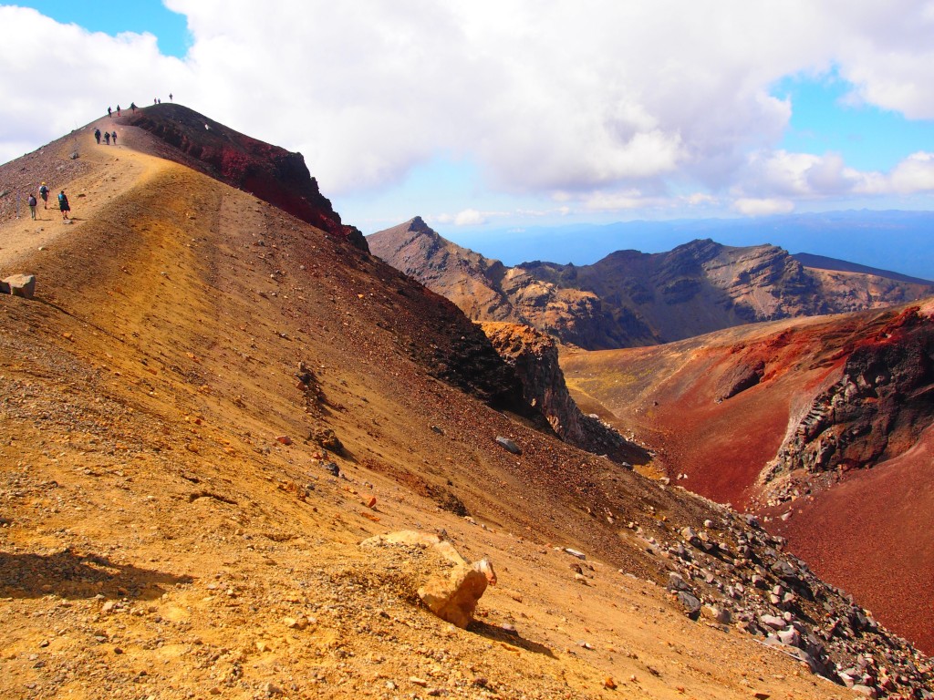
- Peak of the climb before lakes

-
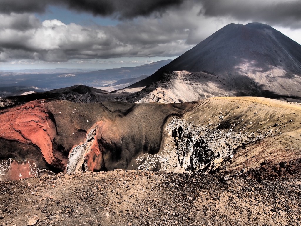
- Mt. Ngauruhoe with red rocks dramatic filter

-

- Mt. Ngauruhoe with red rocks color filter
-
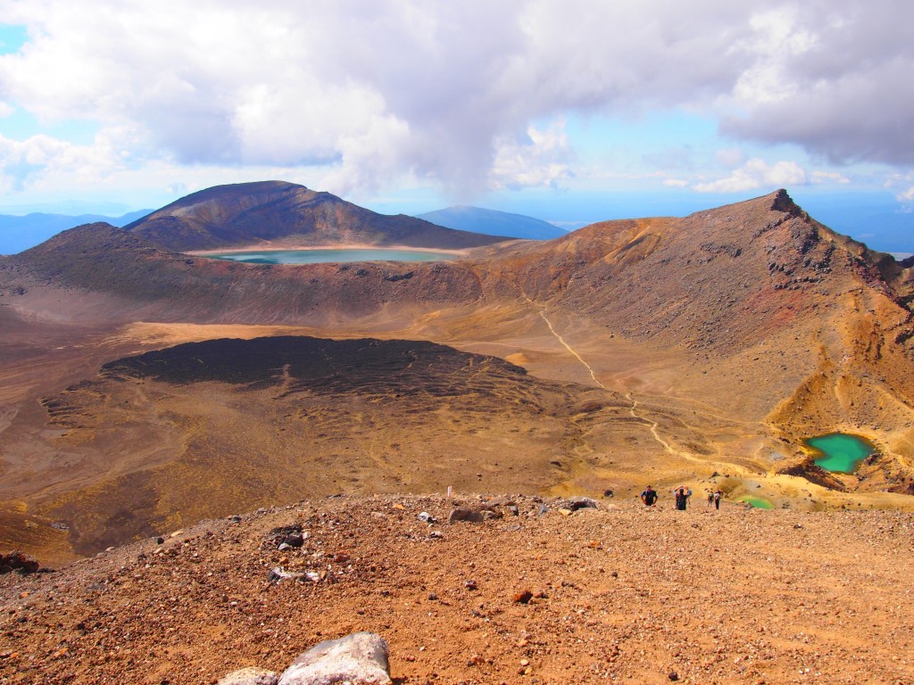
- View looking down towards the green lakes
-

- Red rocks with color filter
-

- Red rocks with color filter
-
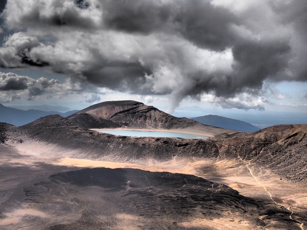
- Dramatic view of the blue lake

-

- Dramatic view of the green lakes
-
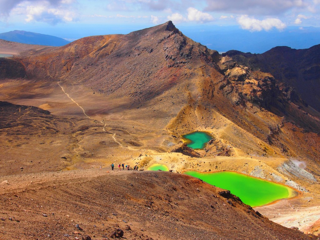
- Color view of the green lakes

-
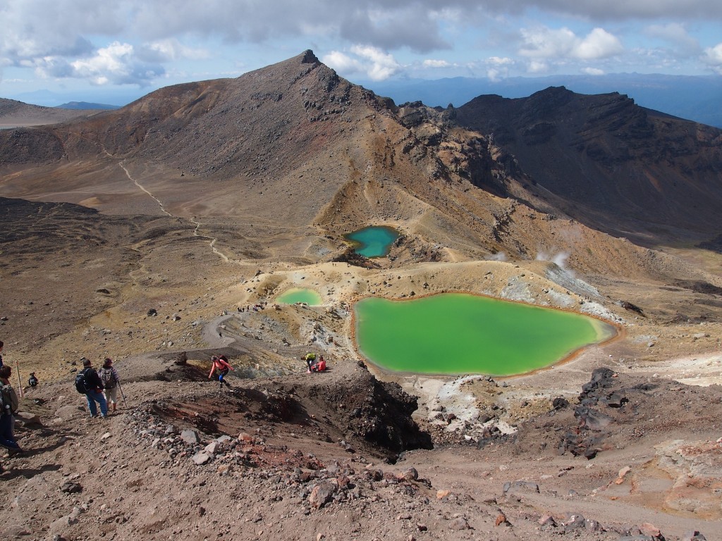
- Green lakes no filter

-
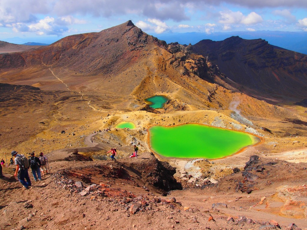
- Green lakes color view2
-

- Green lakes dramatic view2
-
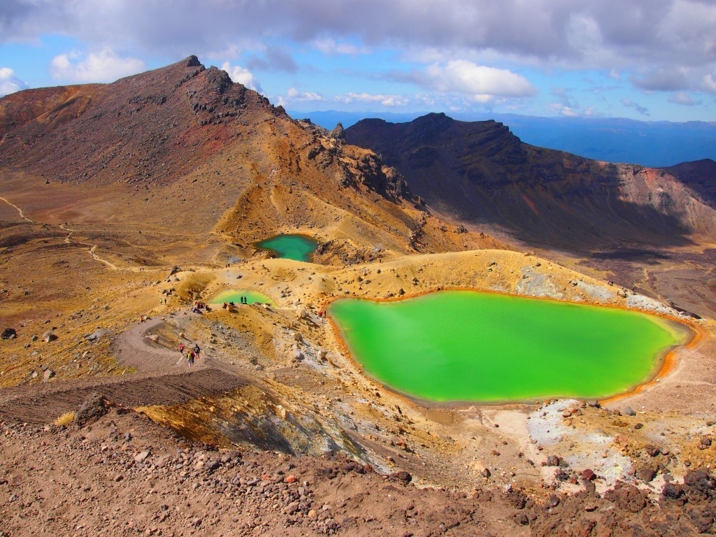
- Green lakes color view3
-

- Green lake full color filter
-
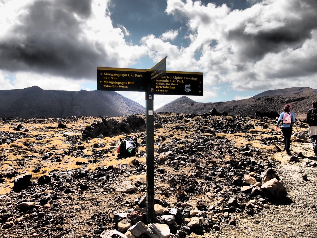
- Tongariro crossing sign
-
- Mt. Ngauruhoe from distance with dramatic filter

-
- Mt. Ngauruhoe from distance

-
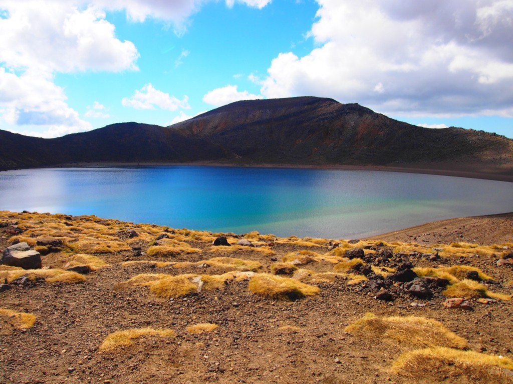
- Blue lake

-

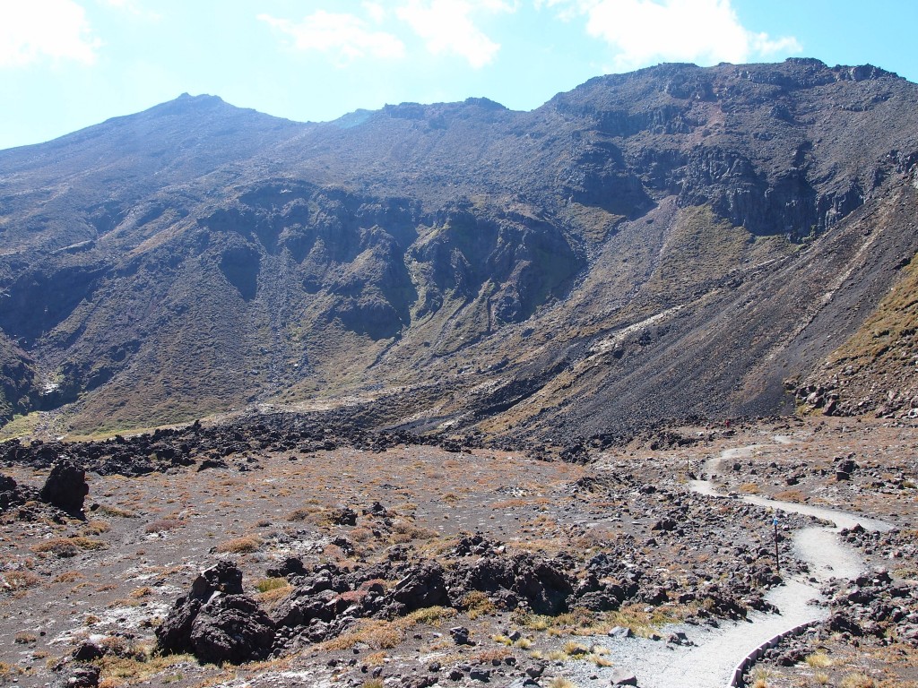
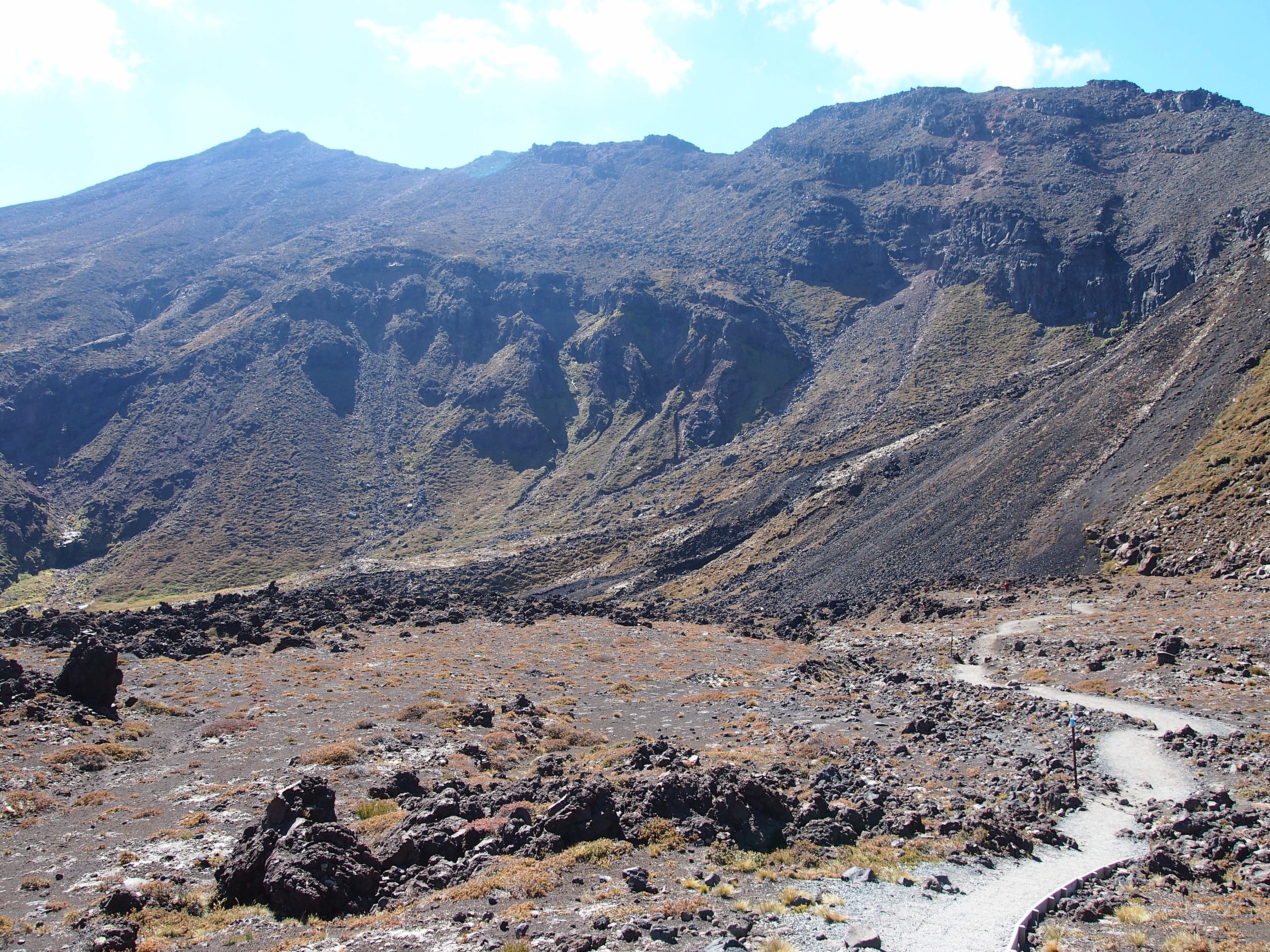
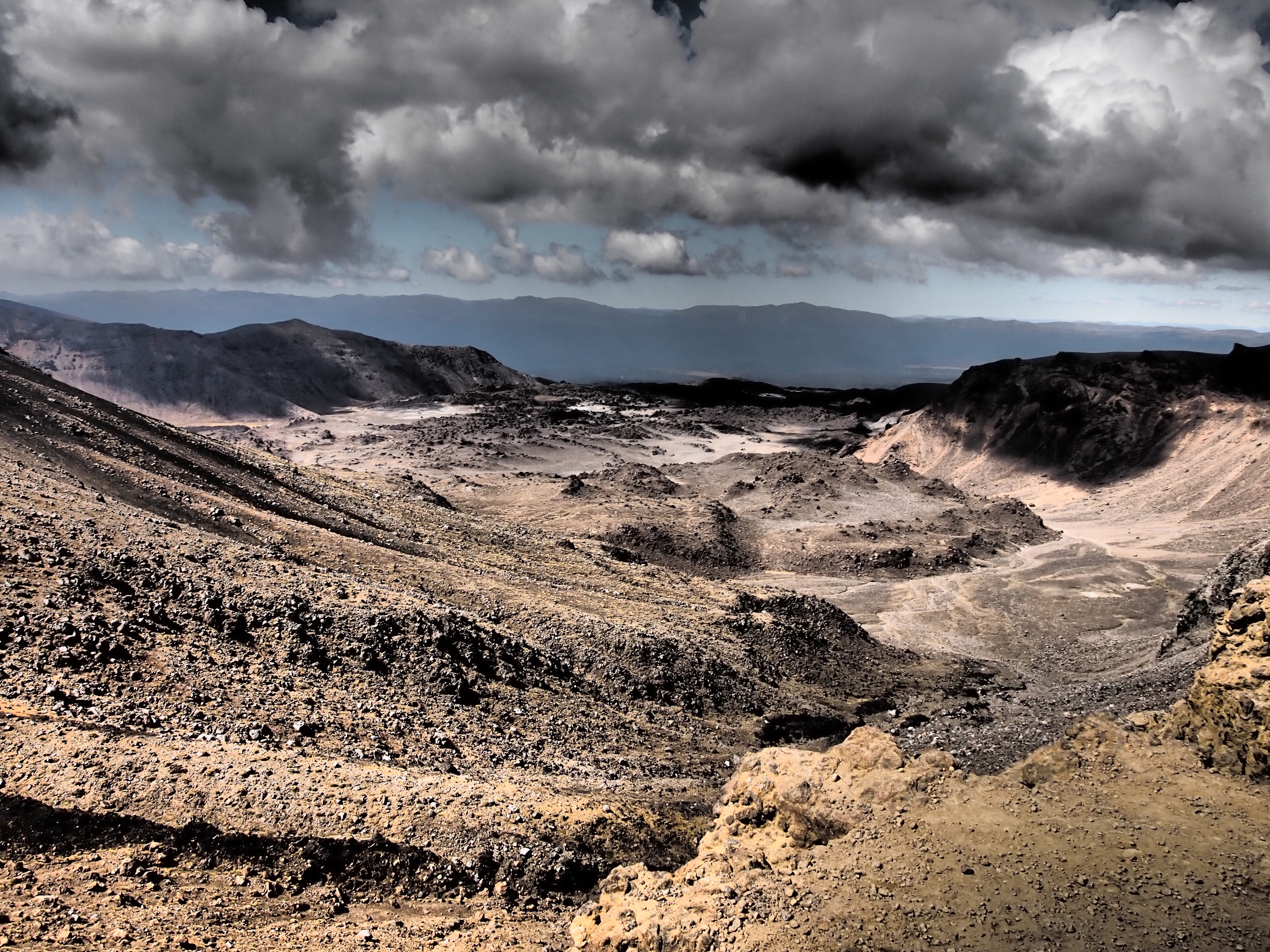
- Valley towards end of trail
-

- Trail going back and forth
-

- Do not enter zone
-

- Active volcanic zone
-

- CamperVan Buffet
Red
Yay another update! You’re still alive! Nice pics!
dasouthface@gmail.com
Sure am, barely… 🙂
Grizzly
Your van looks to have much less candy than I was expecting…
Those are some pretty wild shots, it looks like you took a detour to Mars or something!
dasouthface@gmail.com
This campervan is one sink, one microwave, and one fridge away from being a creeper van. I’m surprised that it is plain white. I’m guessing they just bought it, fixed it or ran out of logos. Nearly all of the other vans from this company I have seen have logos.
Keith
Nice story and great picks. Keep em coming. And yes as far as I have always known New Zealanders are Kiwis. I met one in Germany one time and boy could he talk. Be careful
DaSouthFace
The kiwis sure do love to talk. I even met a greanpeace employee who told me some of his protesting stories. He caught himself saying, “ah, it feels like I’m starting to lecture here.” I just replied, sounds like you’re doing what you love, man.
Karen
I am exhausted reading this and really feared you would miss that shuttle. Great colorful pictures. I am impressed.
dasouthface@gmail.com
Ha, thanks for reading it Karen. The Germans I talked to in Auckland actually did miss the shuttle so it did have me a bit more nervous. They said they lucked out with a hiker who was there late and was kind enough to give them a ride (its about a 30 min drive).
jesscampos
Omg the pics were awesome! The green lakes look amazing. …what makes them that way? Also….R u speaking in German to the Germans lol or do they speak English? Might sound like a dumb question but I’m curious lol